Site Intelligence
Working toolOne location, one click: a cited reading of your site. Drawings, a 3D model, simulations and booklets from the same study.
Use Site IntelligenceSite Intelligence works today. The rest connect to the same brain as they arrive.
Choose the siteSearch or paste coordinates, pick the map, shape the area.
Use Site IntelligenceScreen recordings of the real tool on the Khairatabad, Hyderabad study. The cursor, click ripples and zooms are added in editing, and some slow stretches are sped up.
One working tool today, one in beta, and more in prototype and in the pipeline.
One location, one click: a cited reading of your site. Drawings, a 3D model, simulations and booklets from the same study.
Use Site IntelligenceLays out stalls, aisles and manoeuvres on a site under your rule set. In beta, launching soon.
Join the betaSubdivides land into plots, roads and open space, with area metrics and DXF.
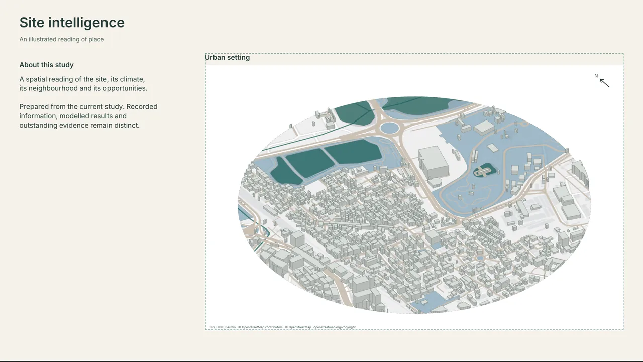
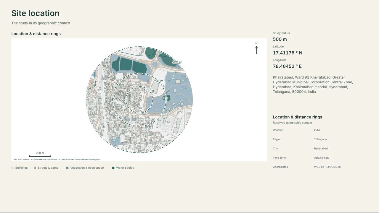
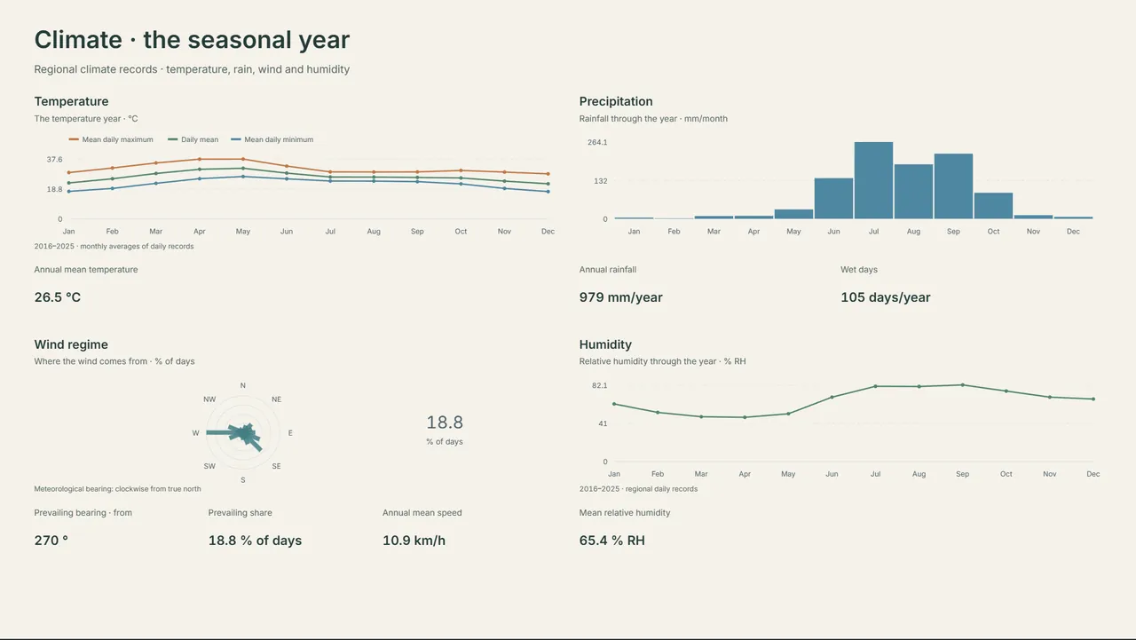
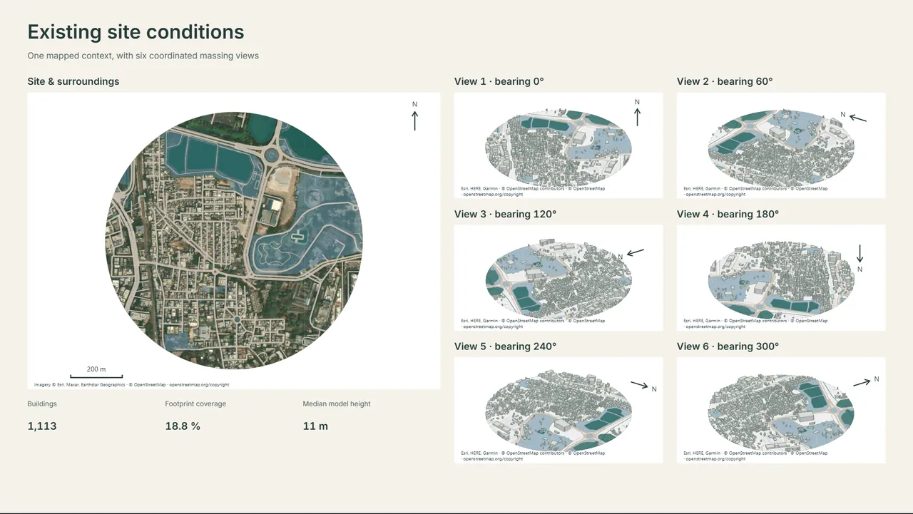
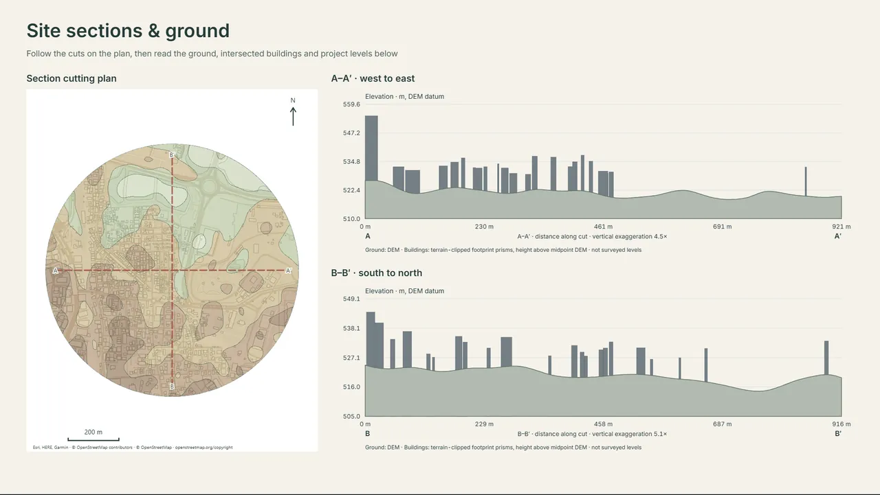
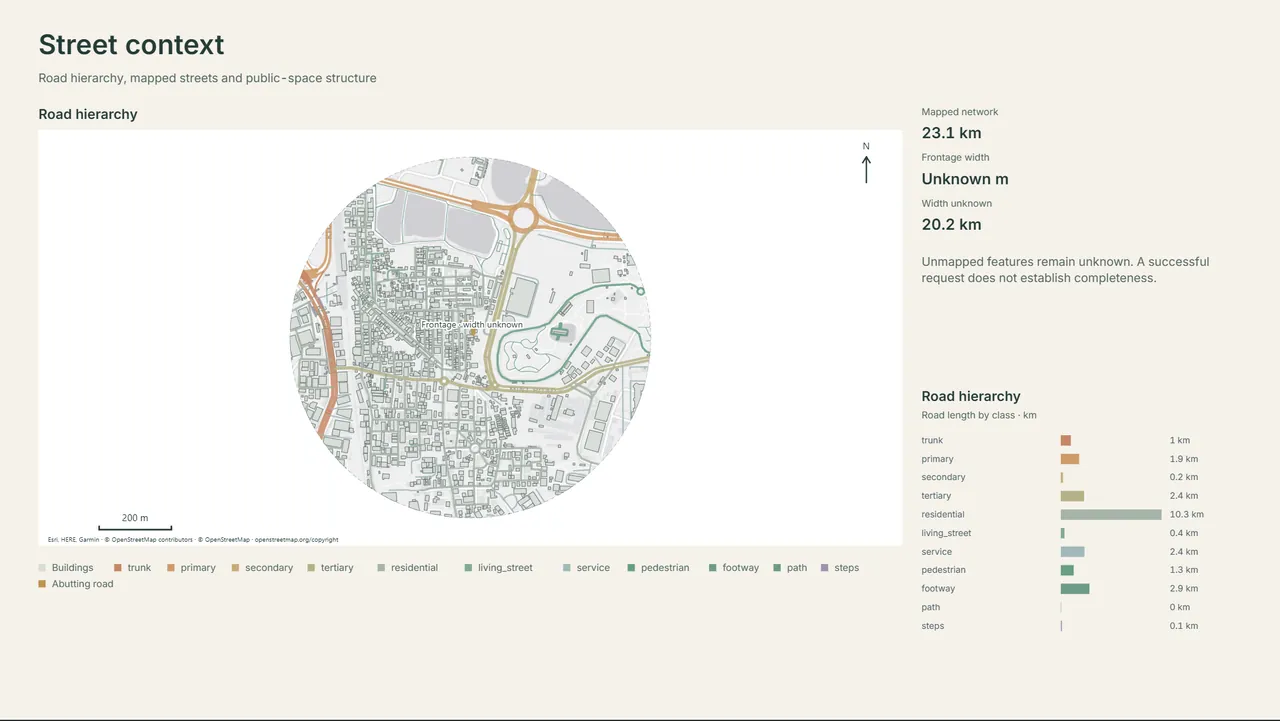
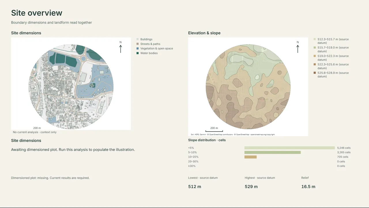
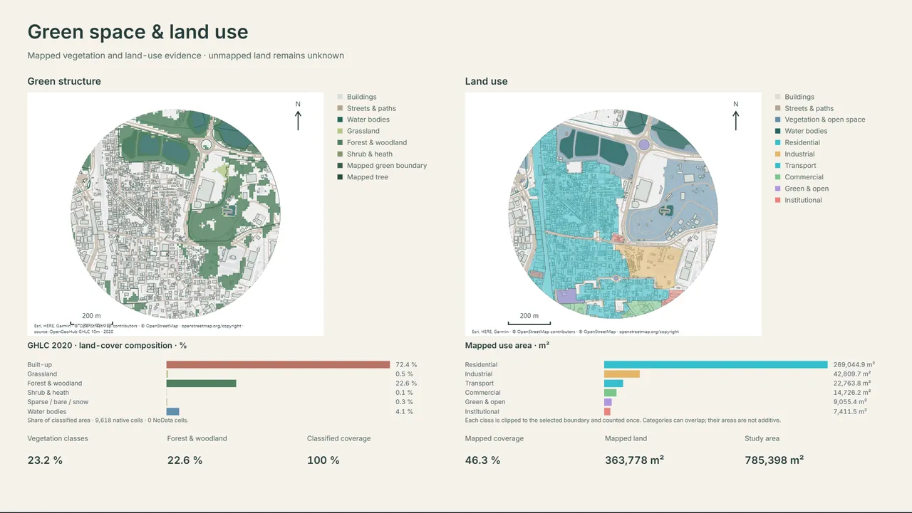
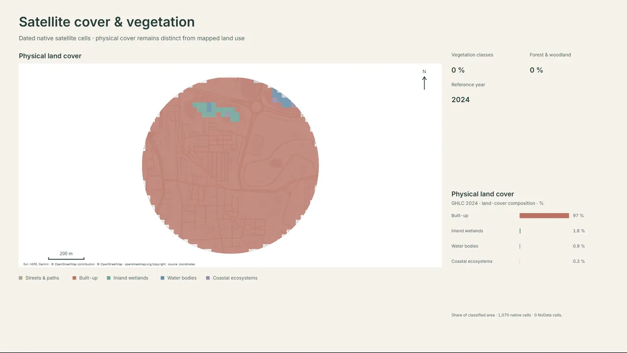
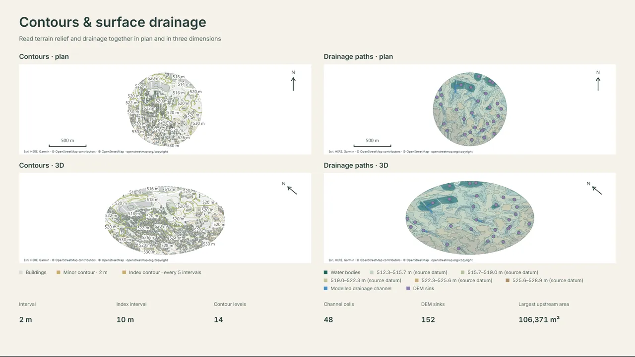
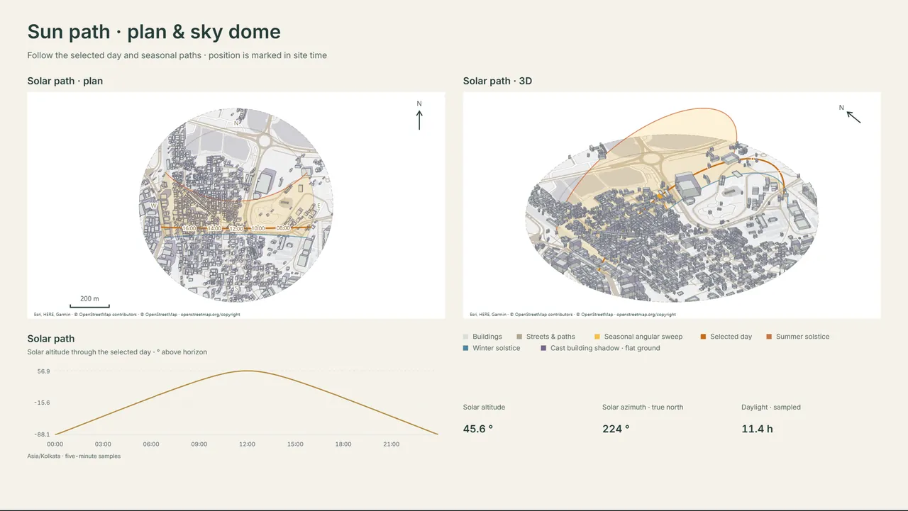
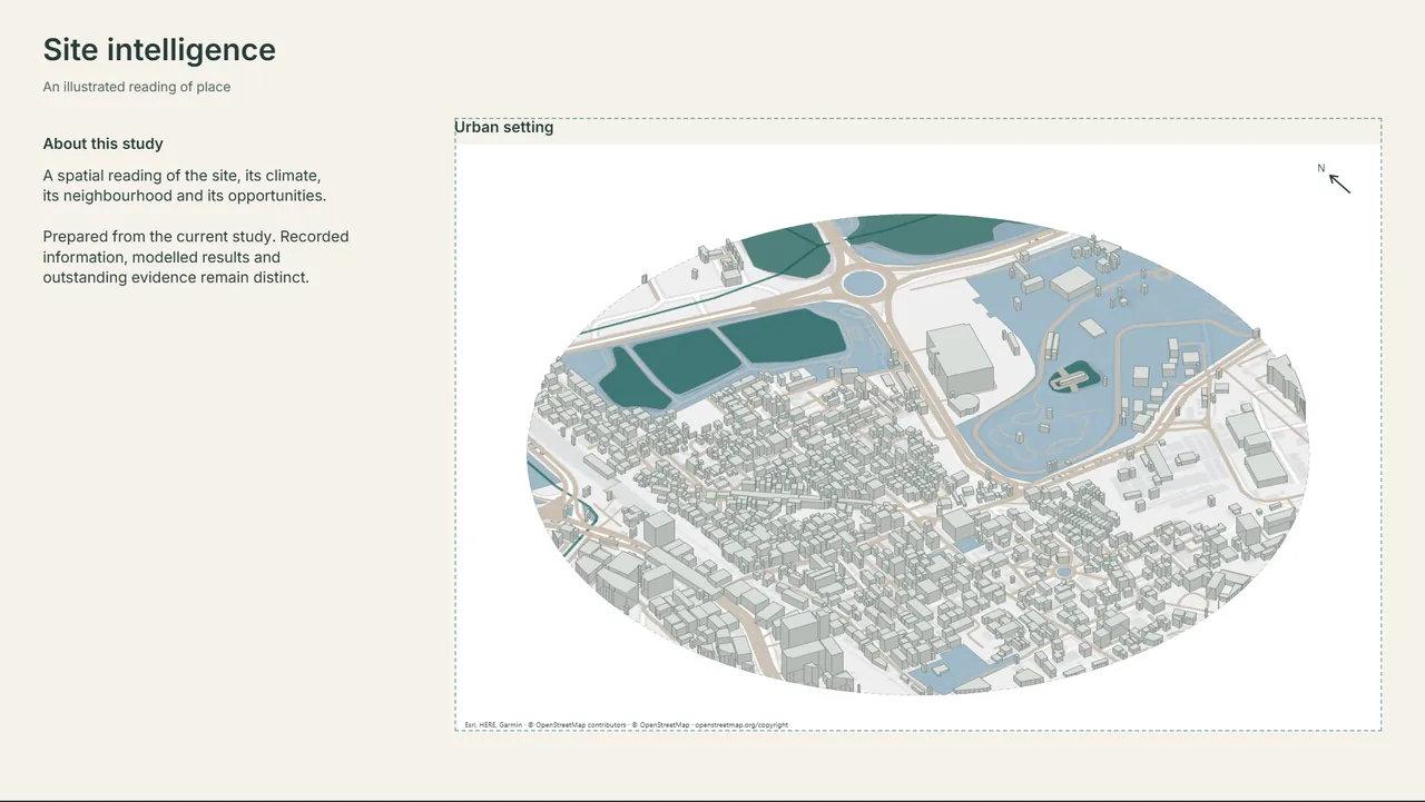
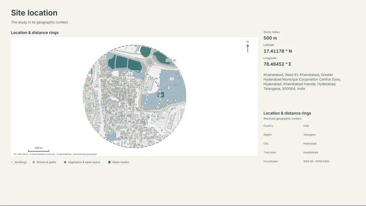
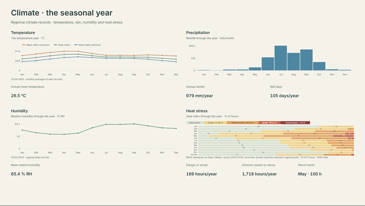
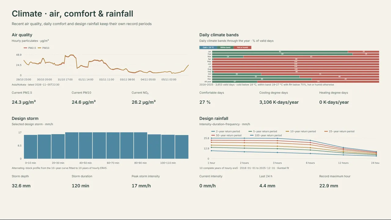
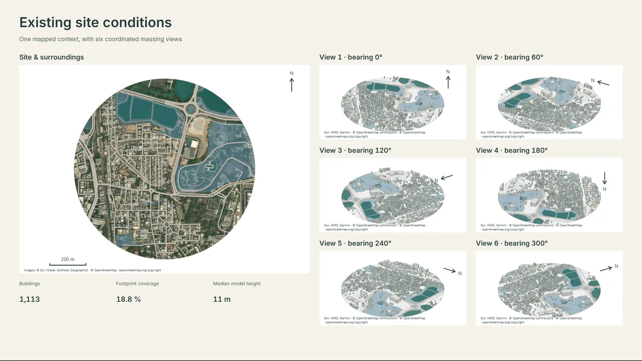
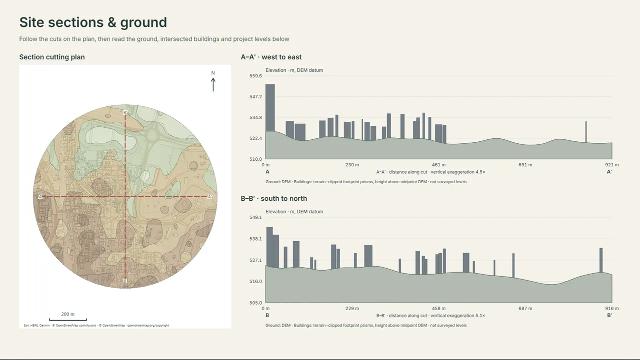
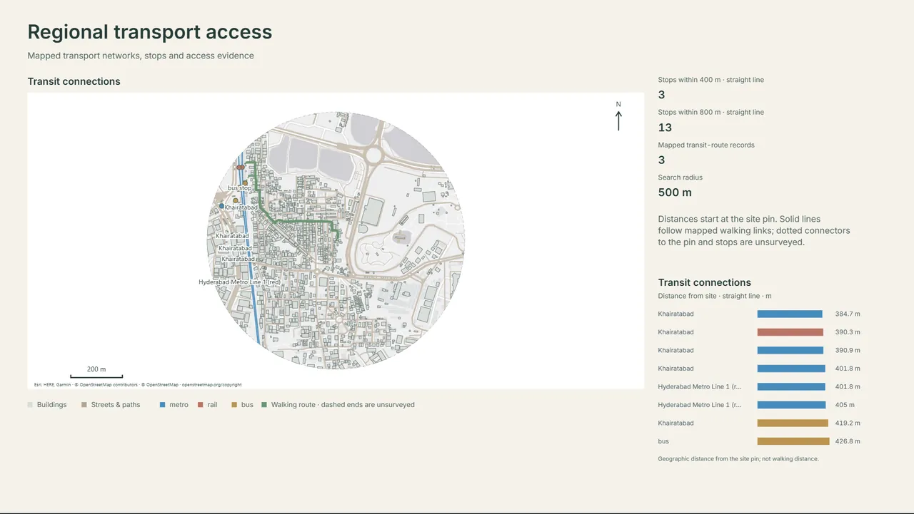
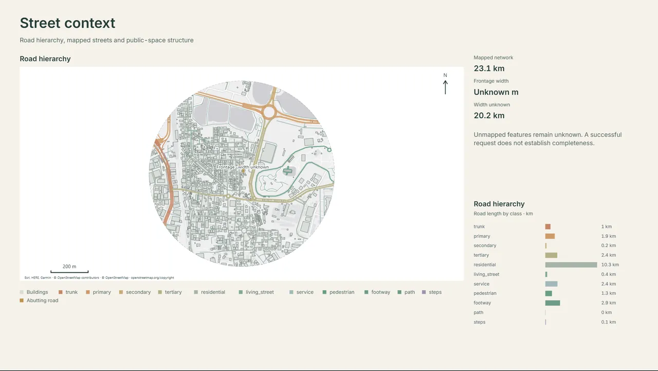
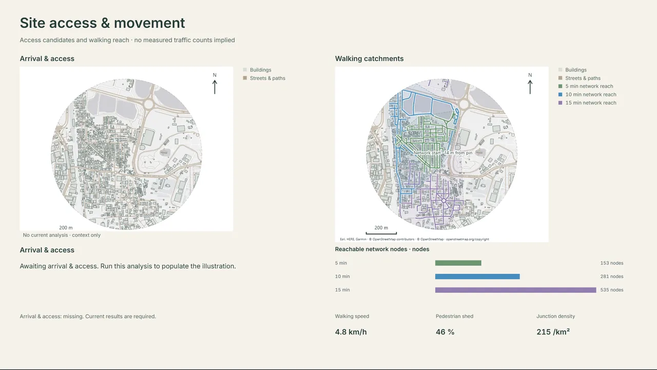
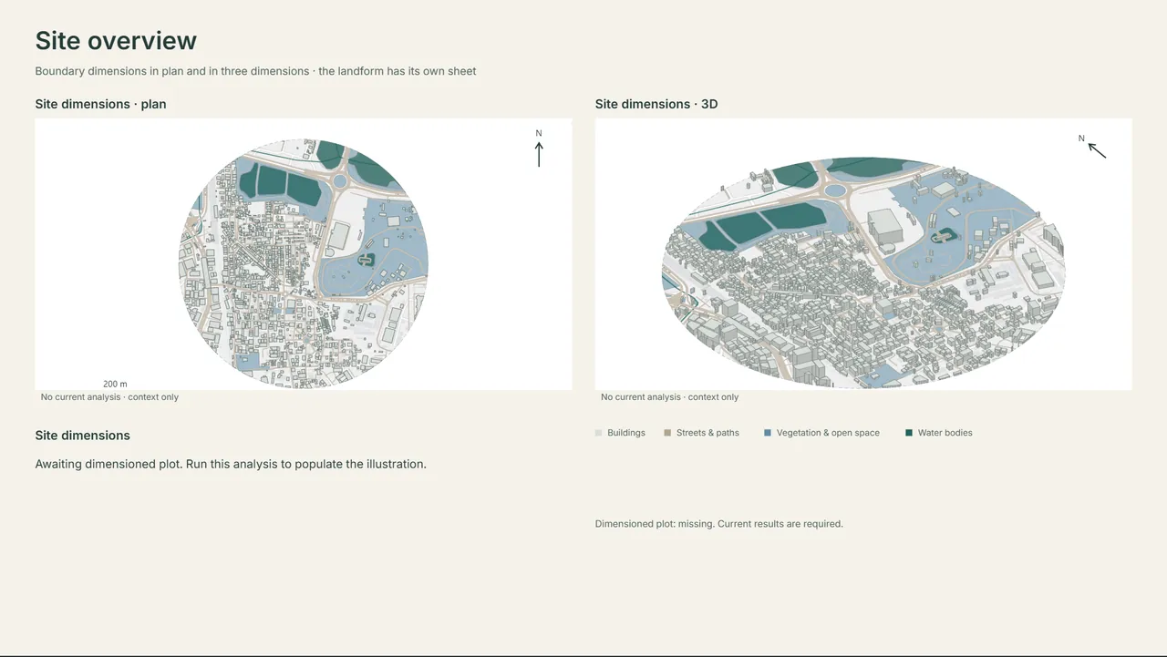
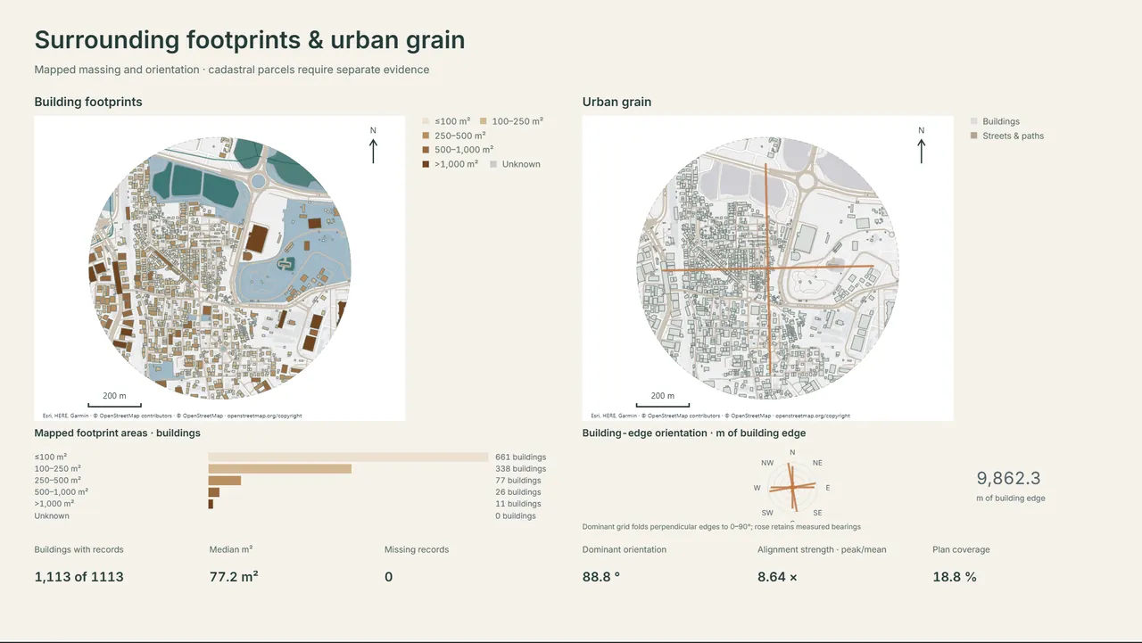
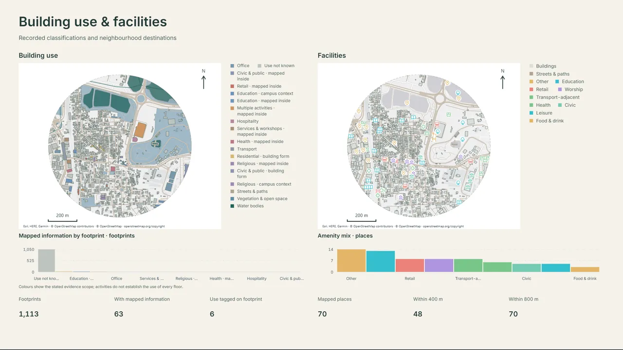
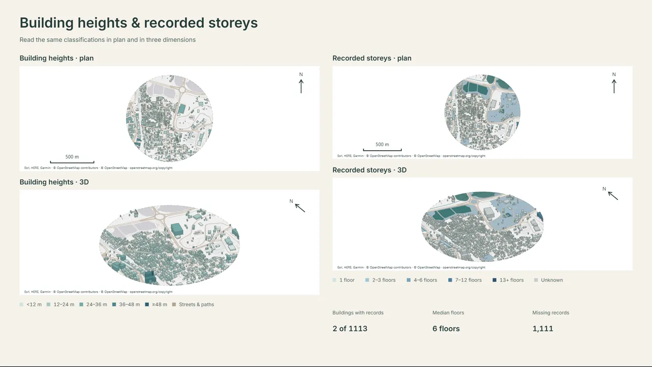
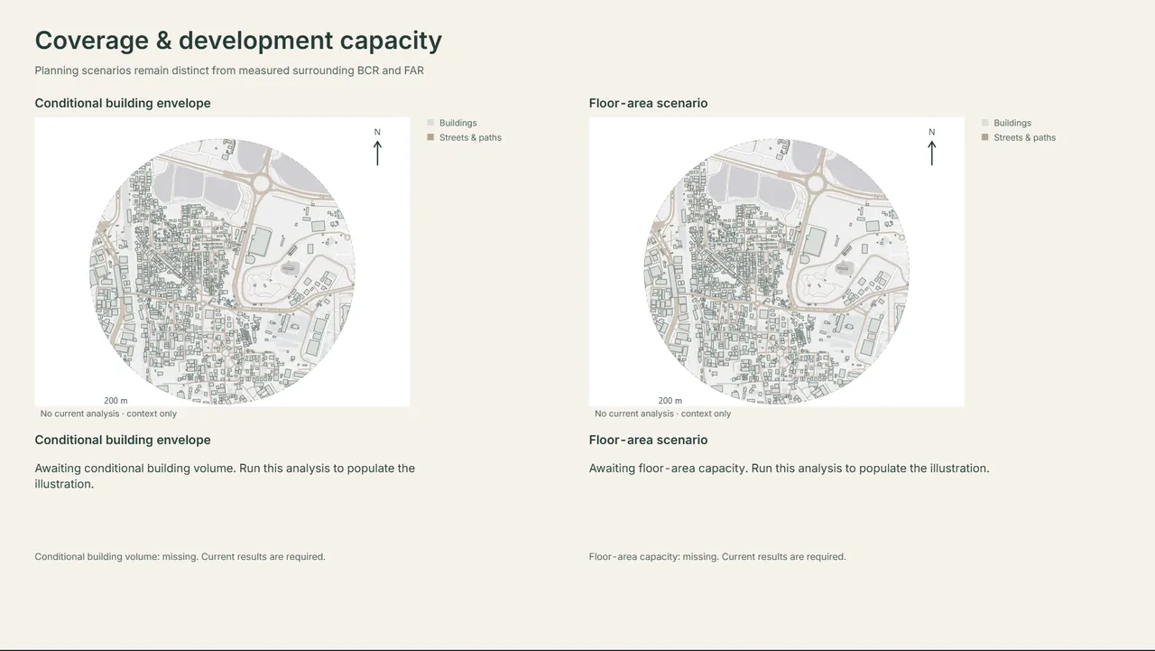
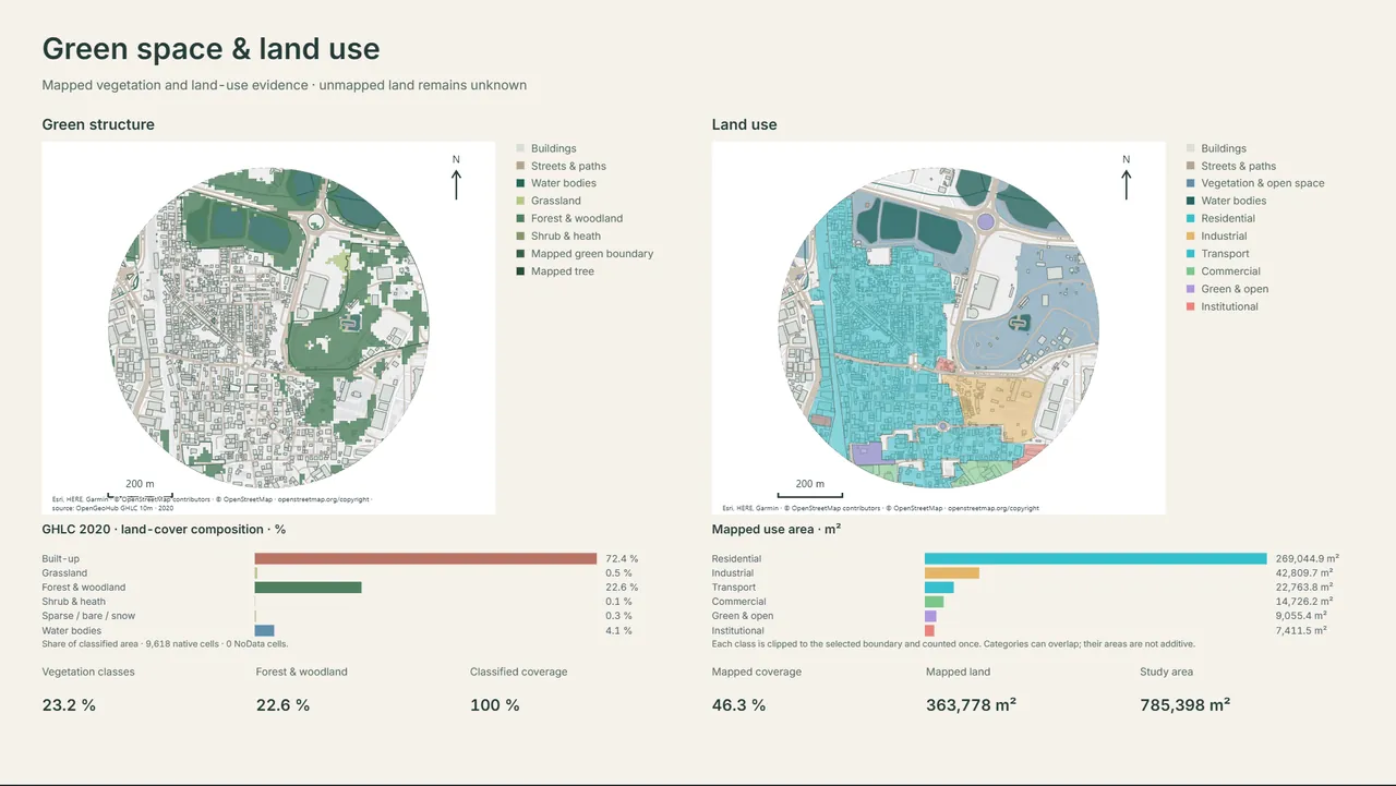
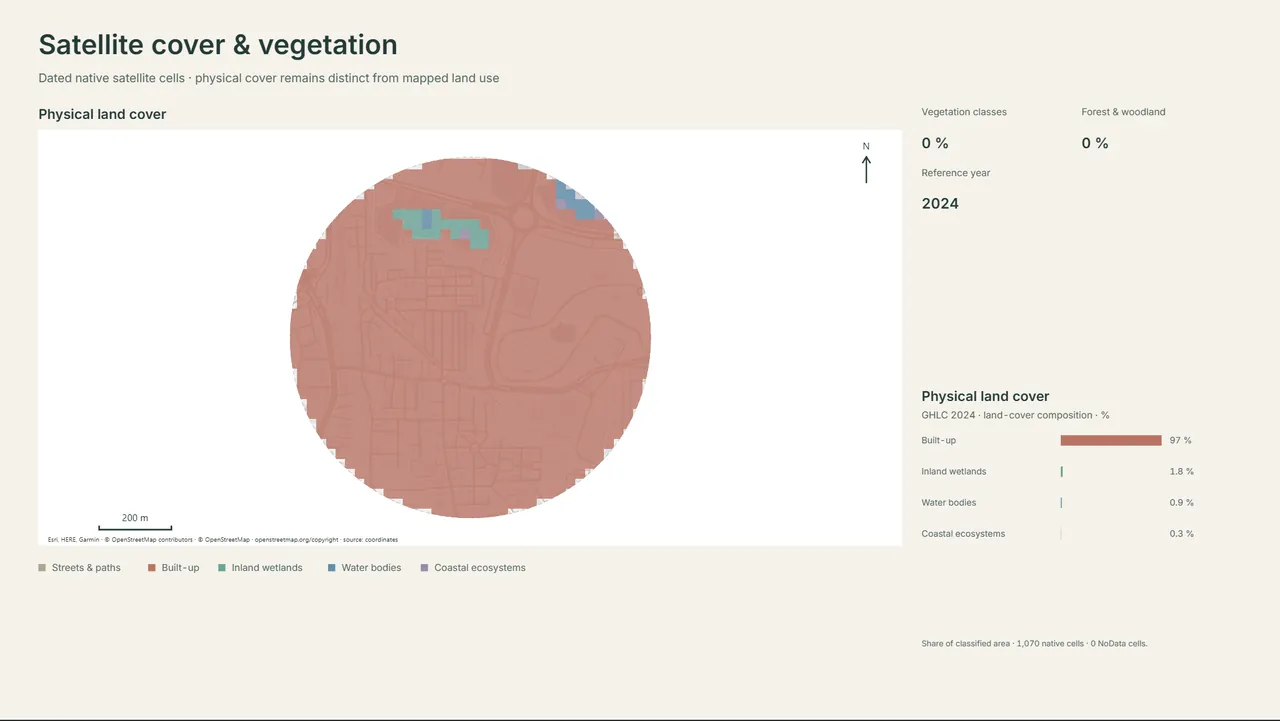
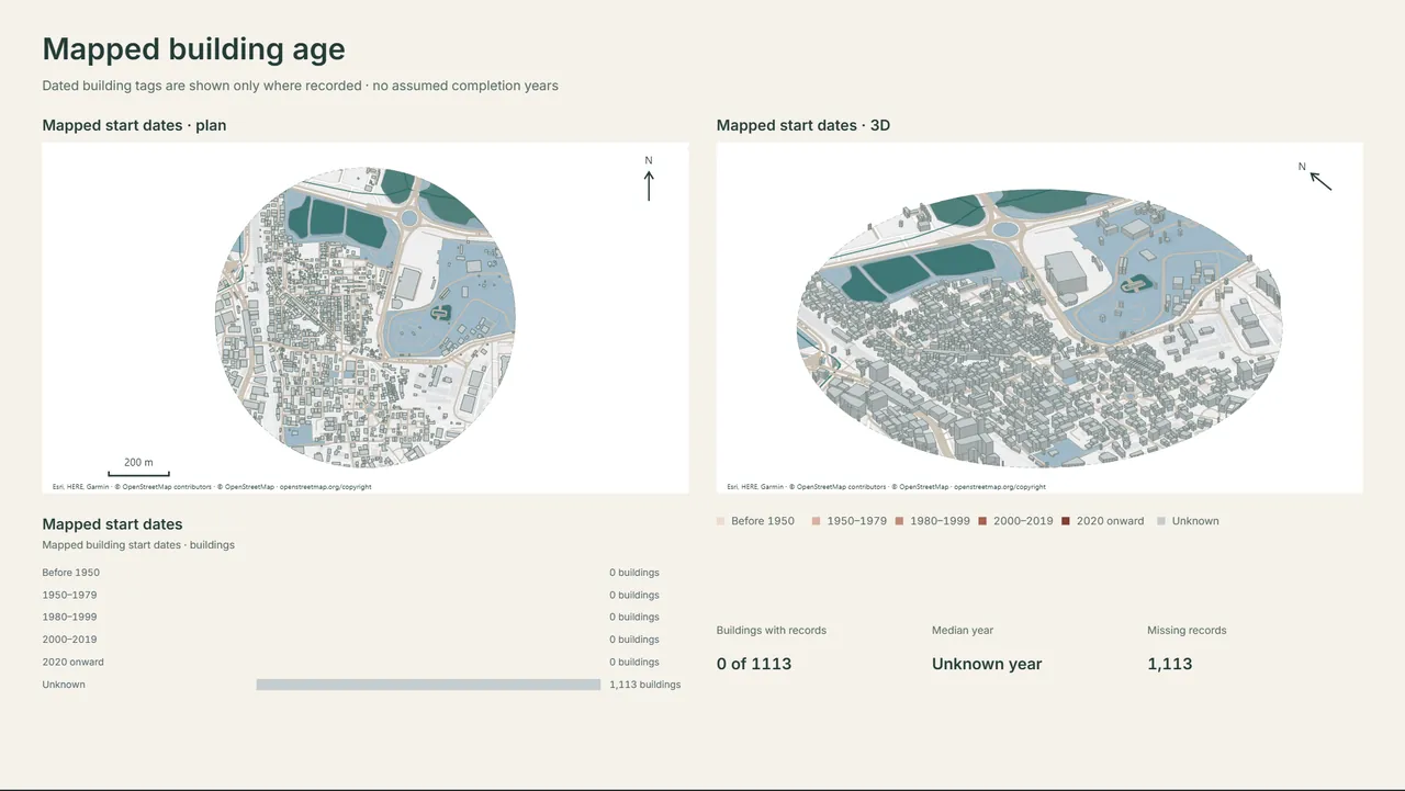
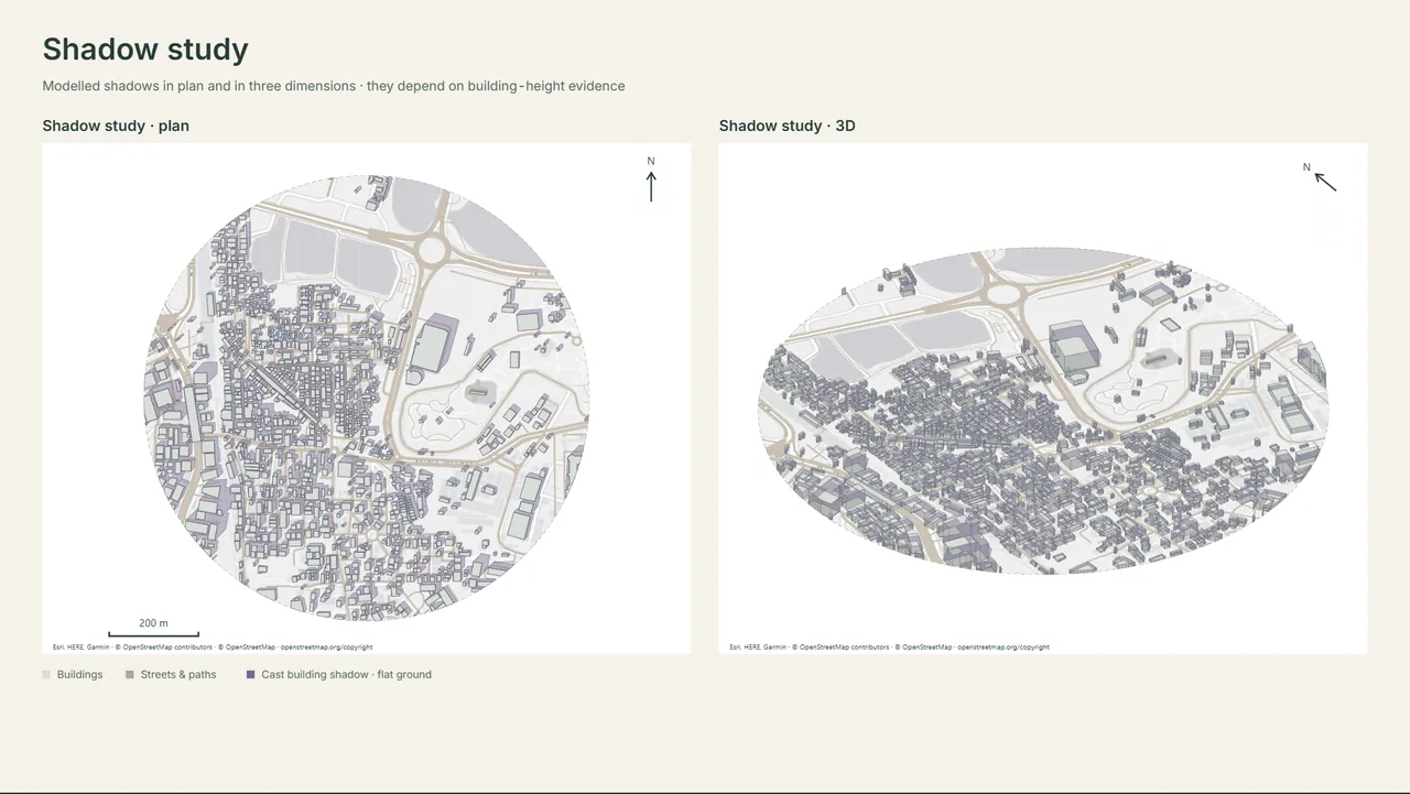
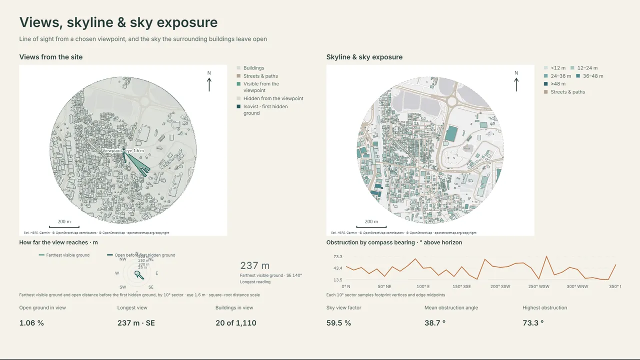
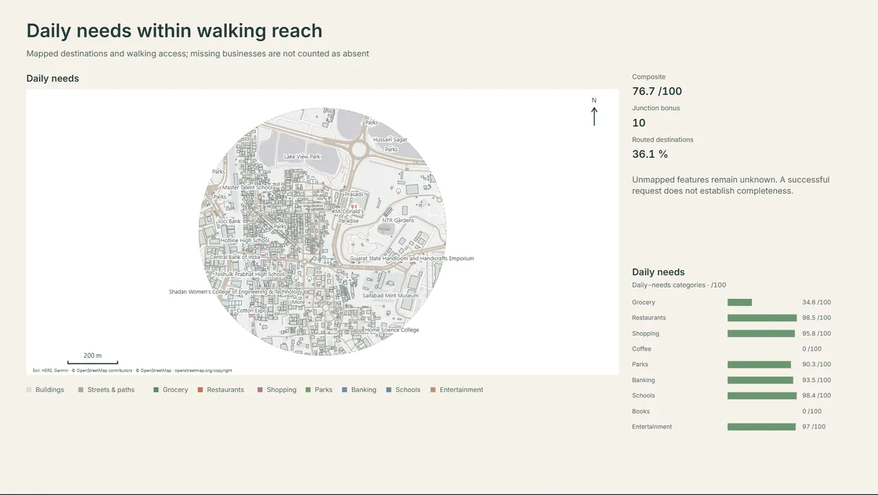
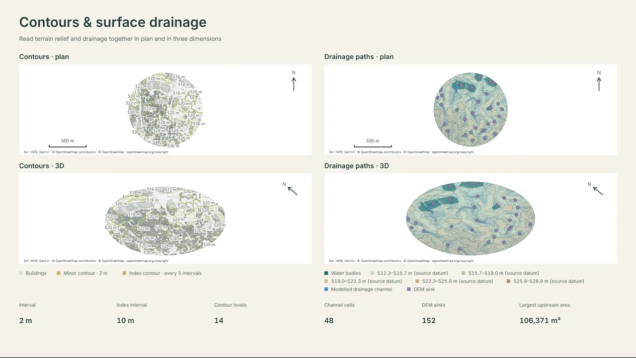
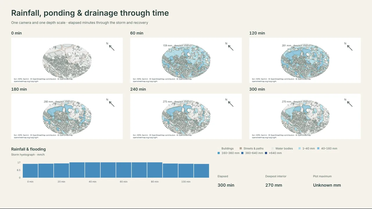
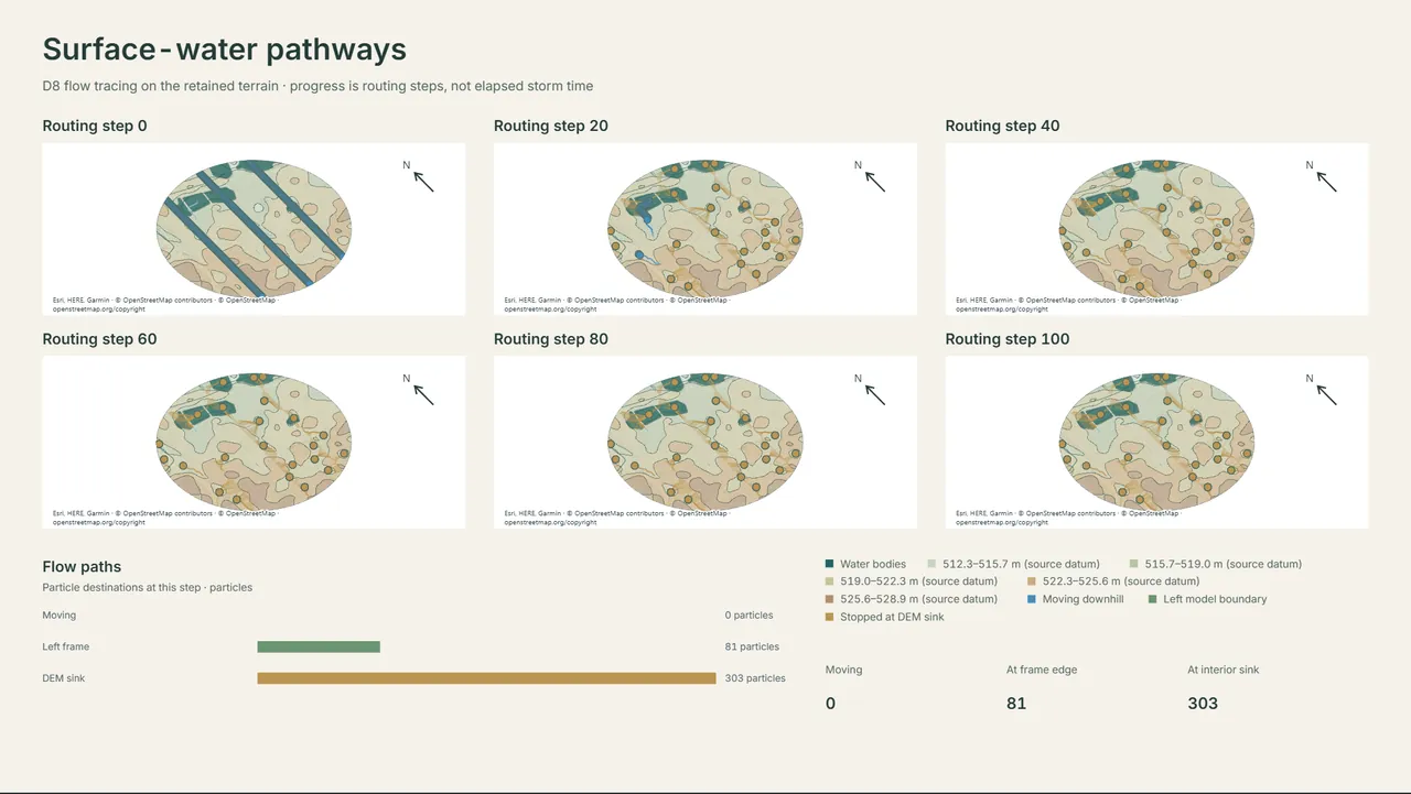
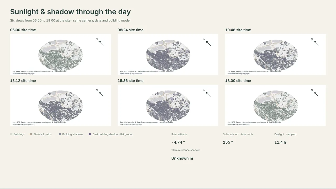
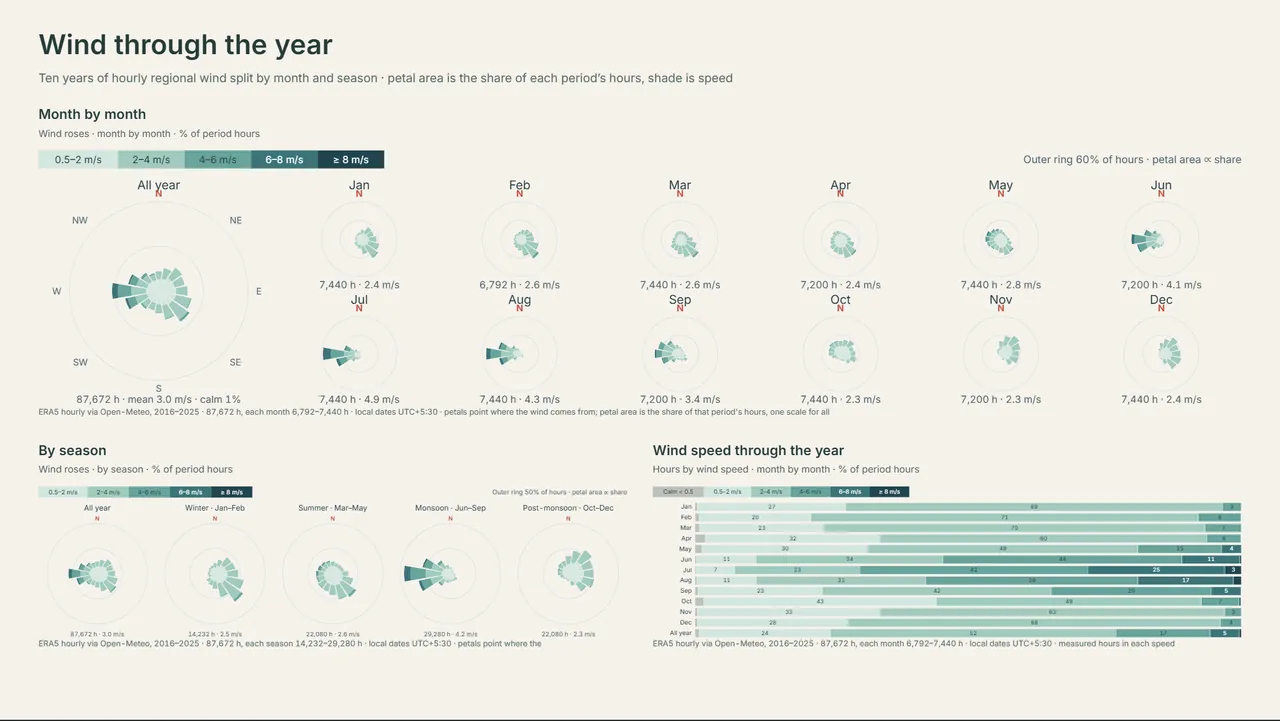
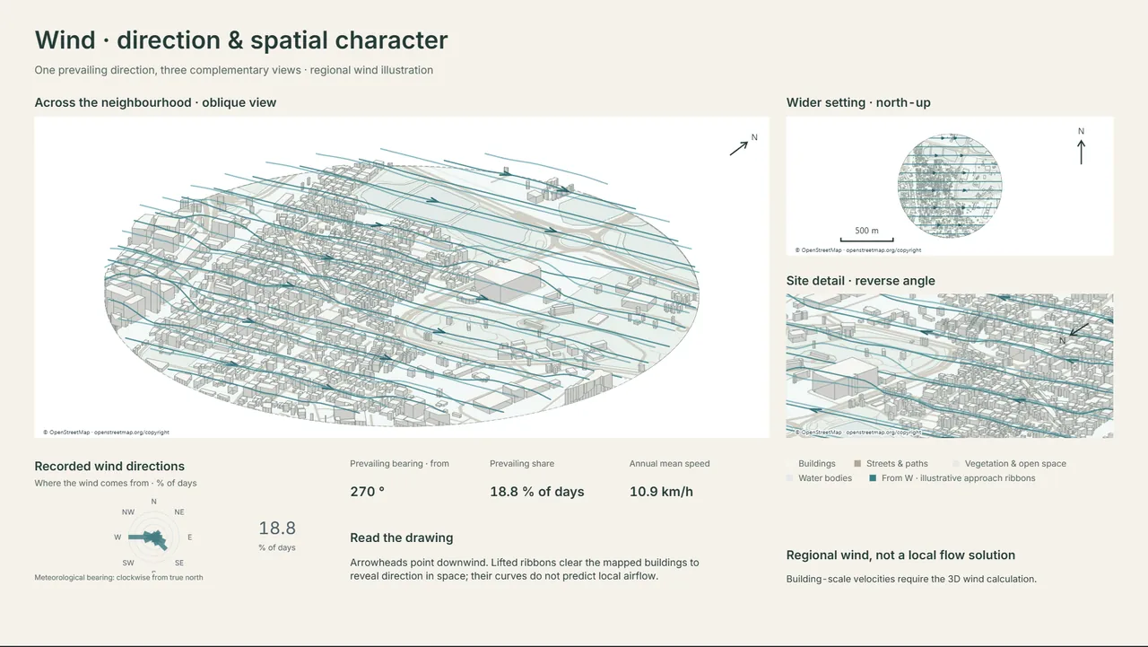
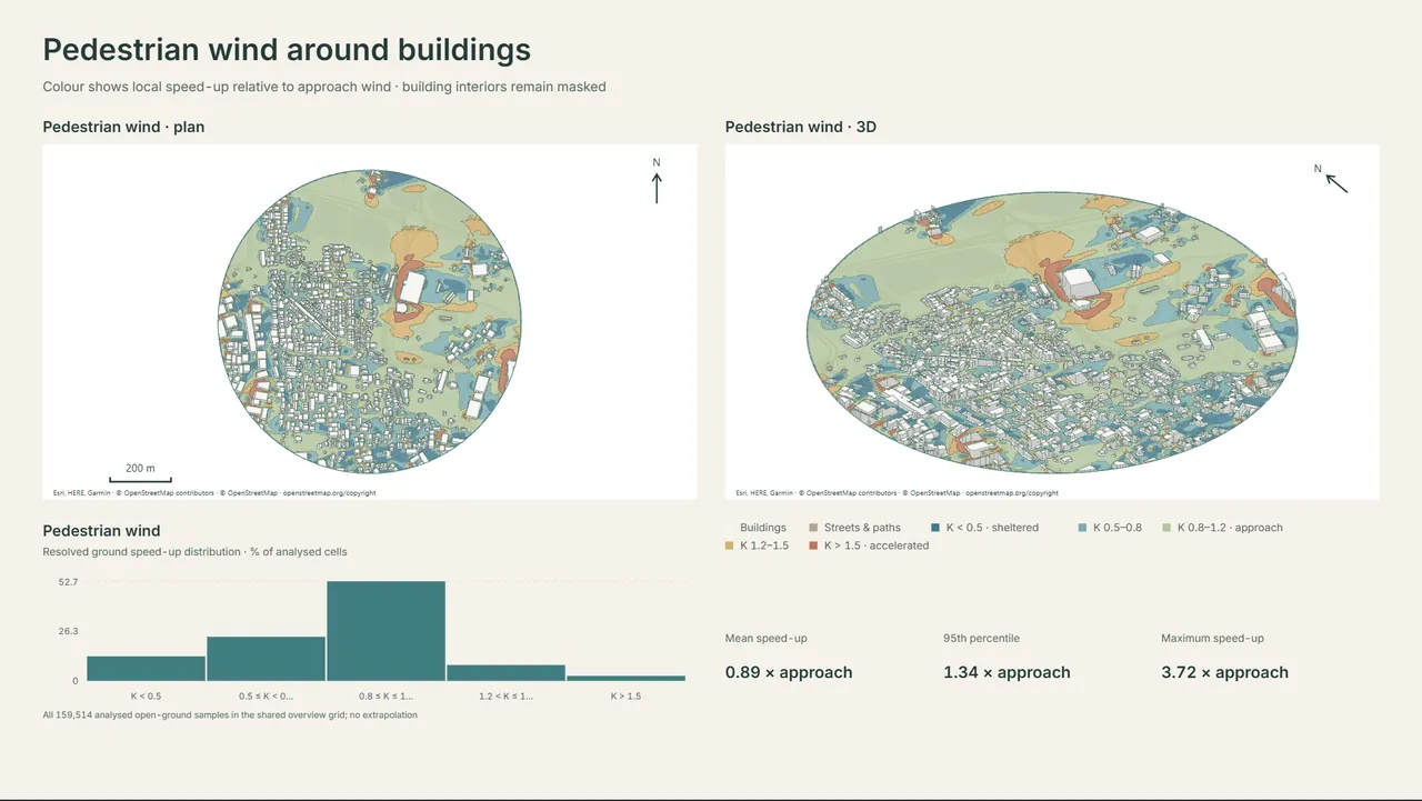
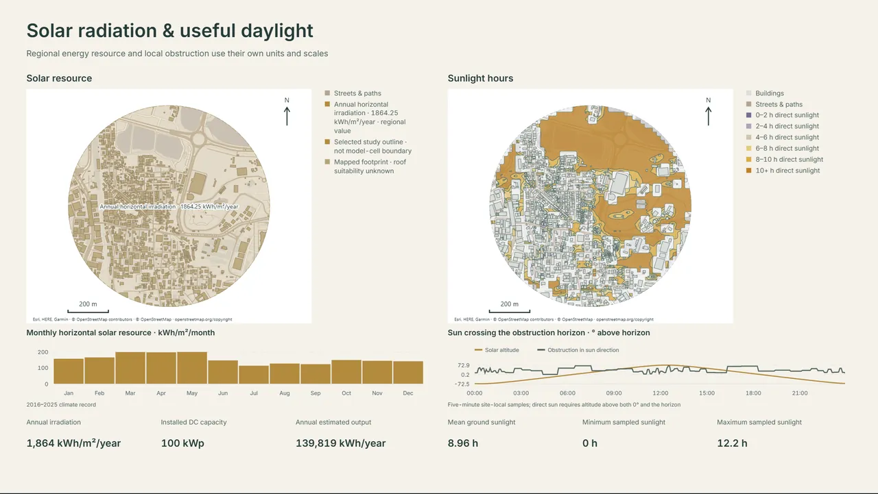
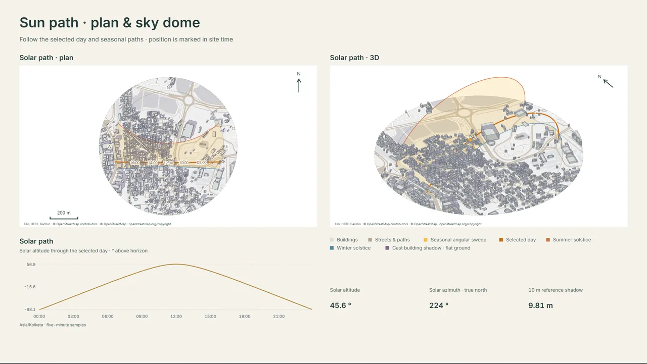
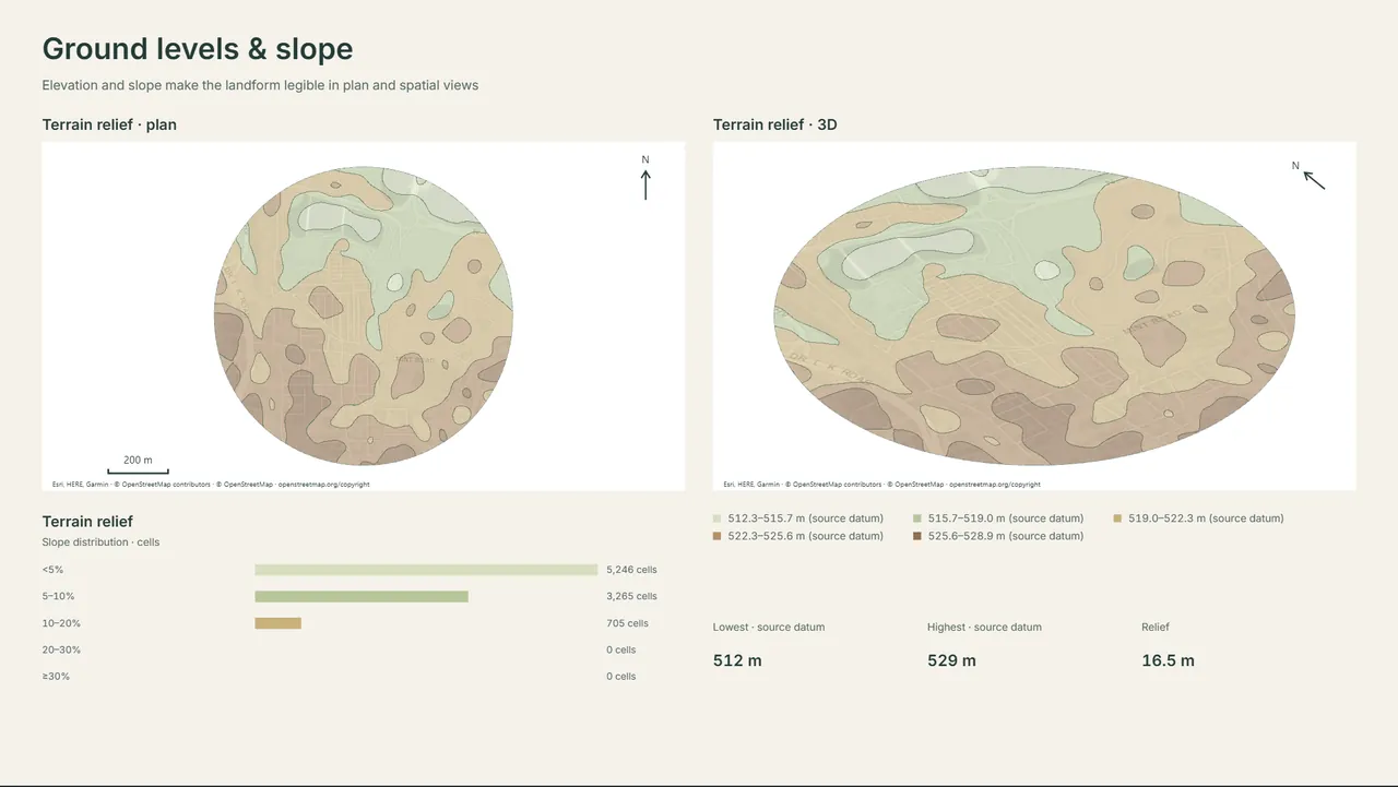
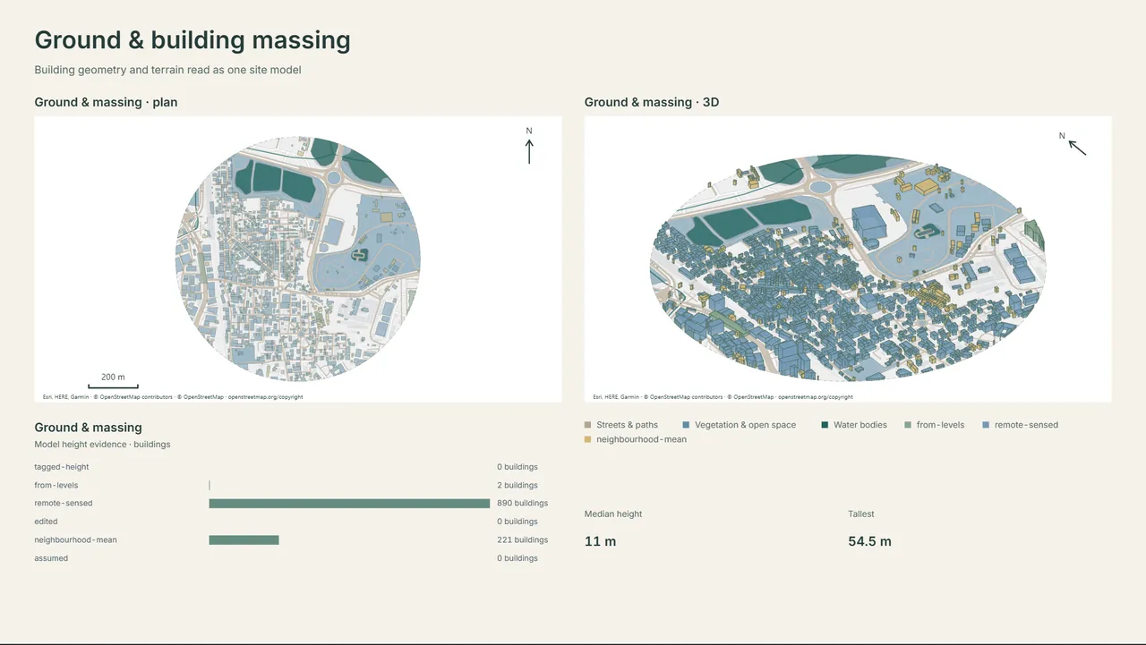
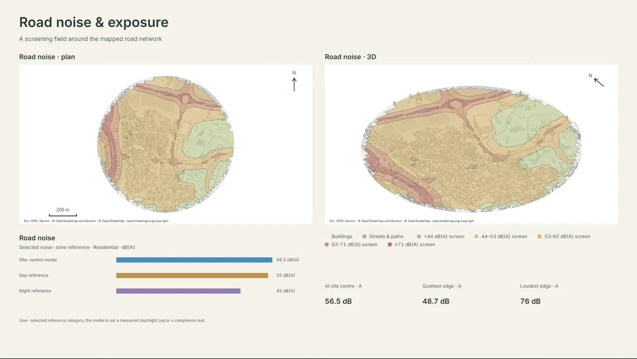
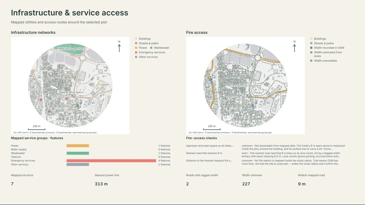
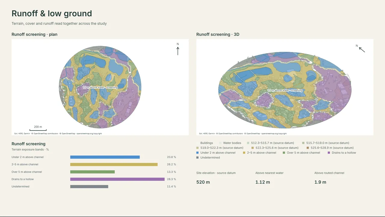
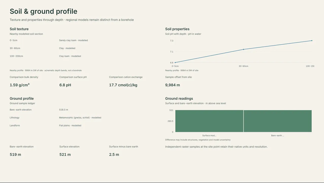
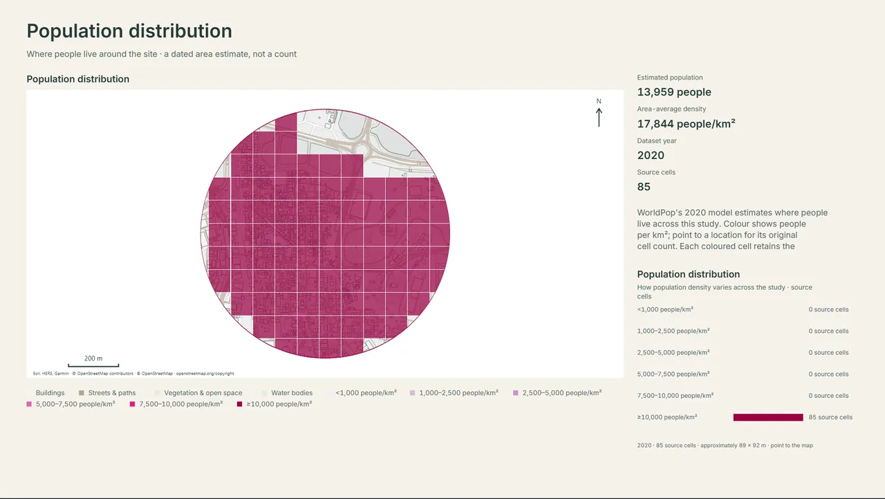
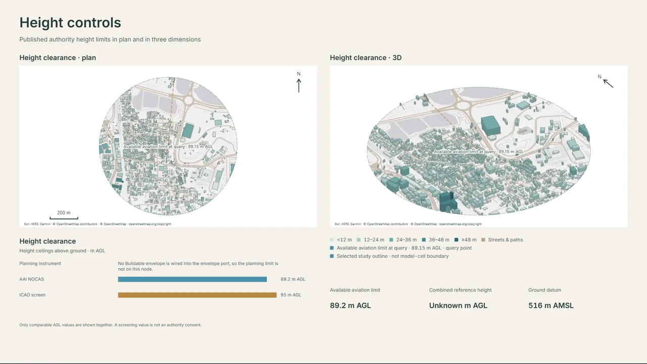
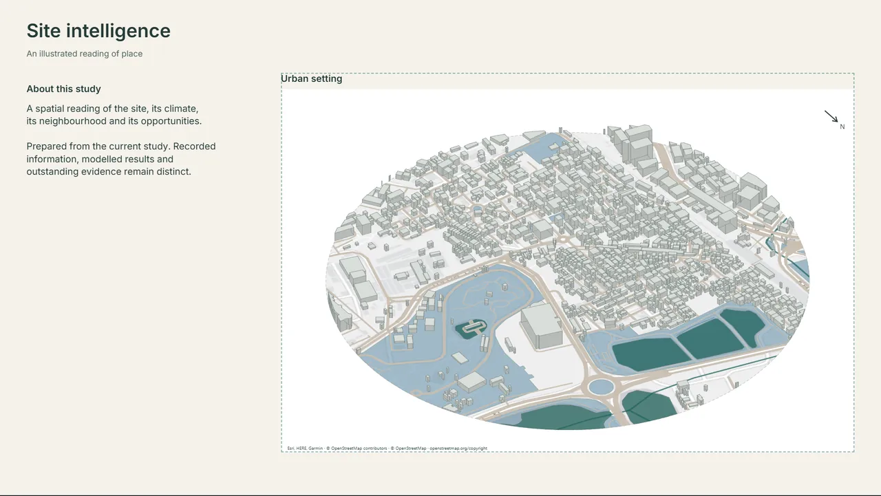
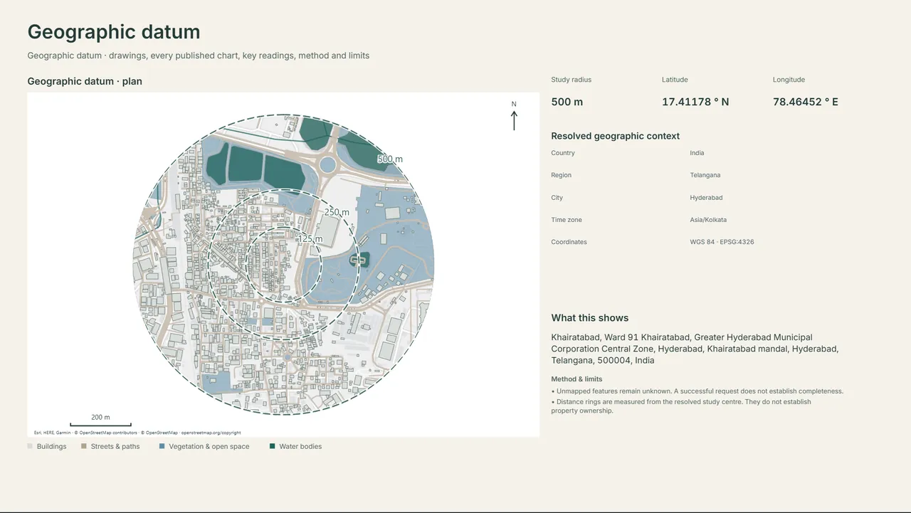
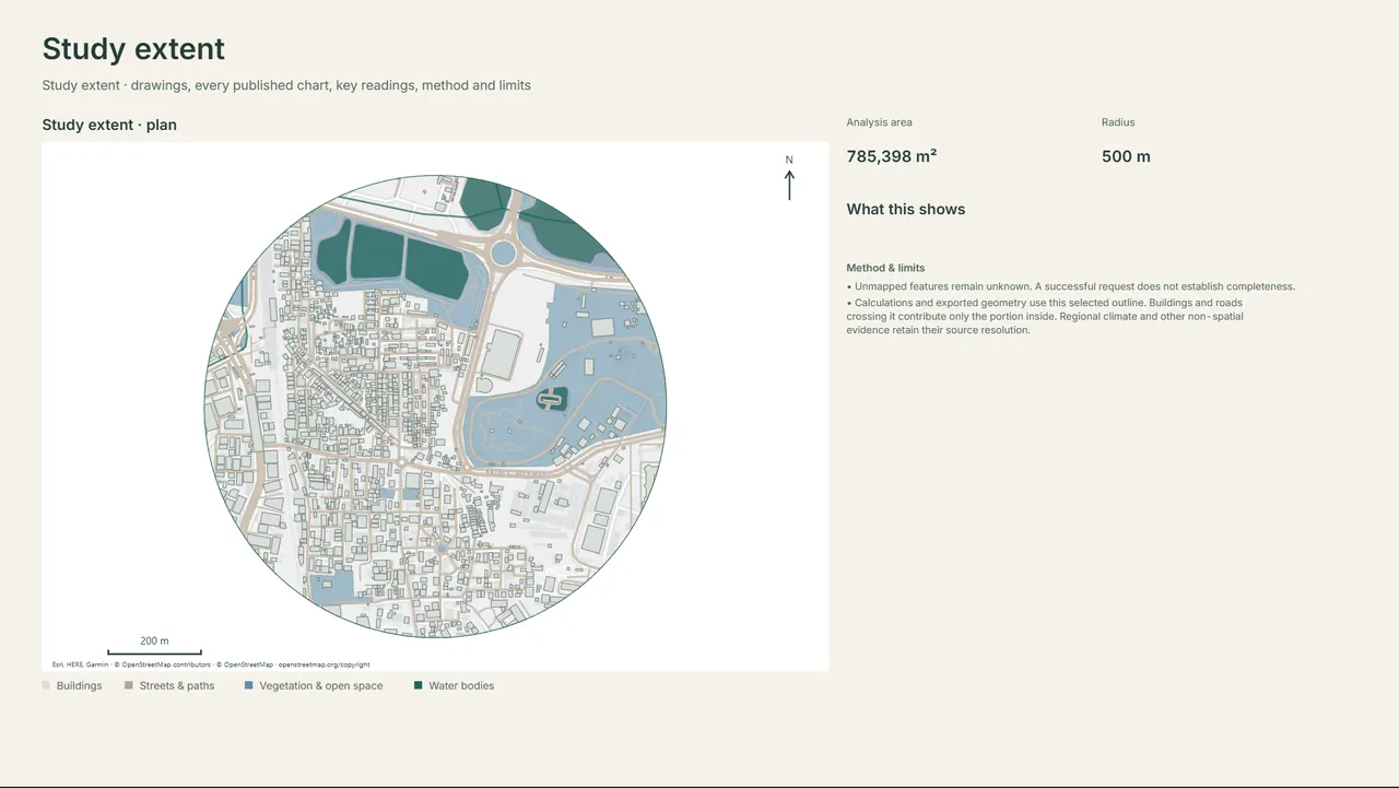
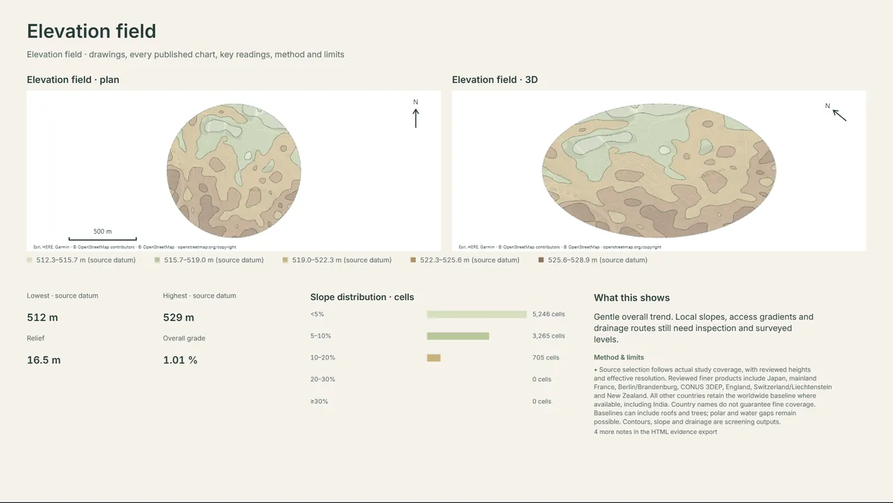
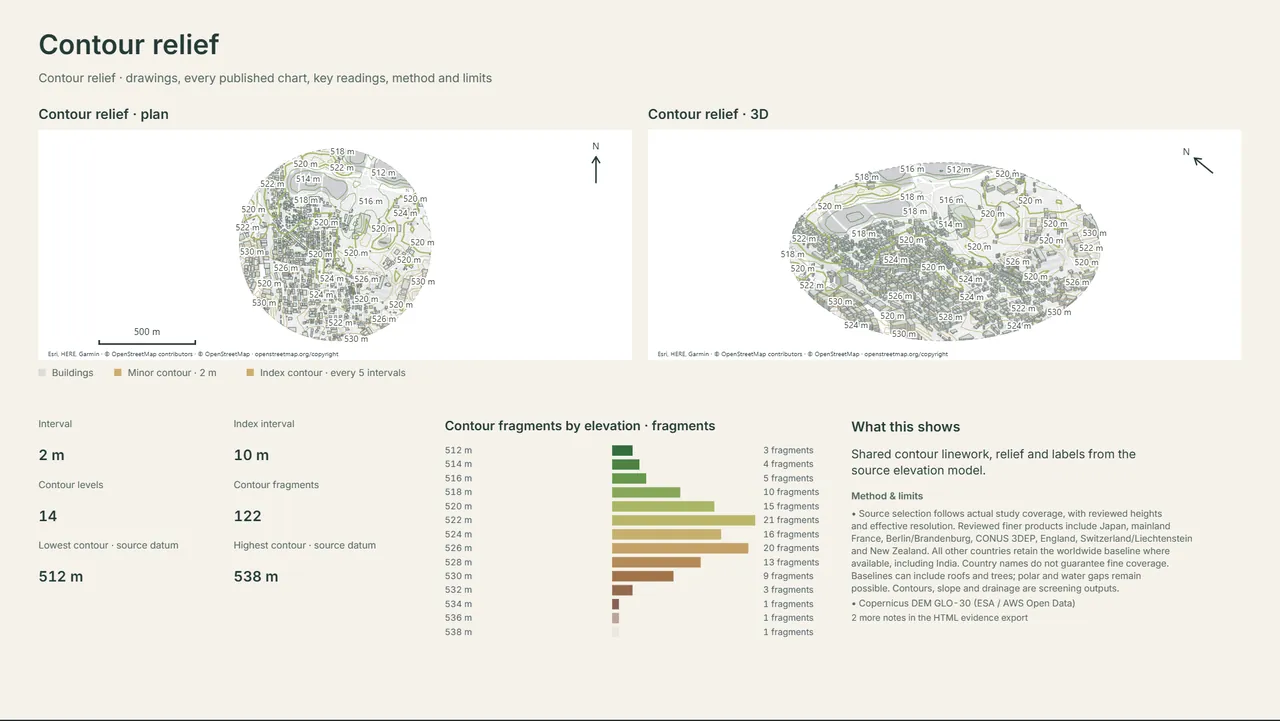
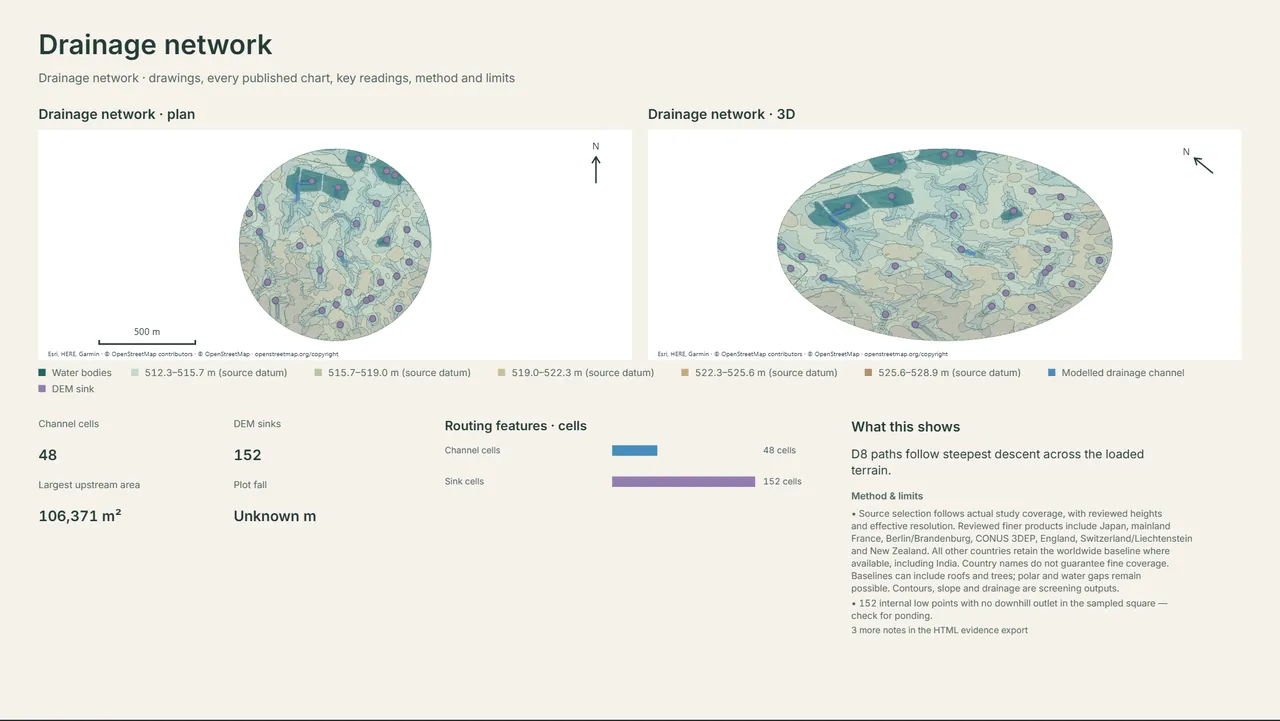
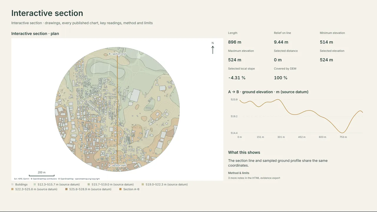
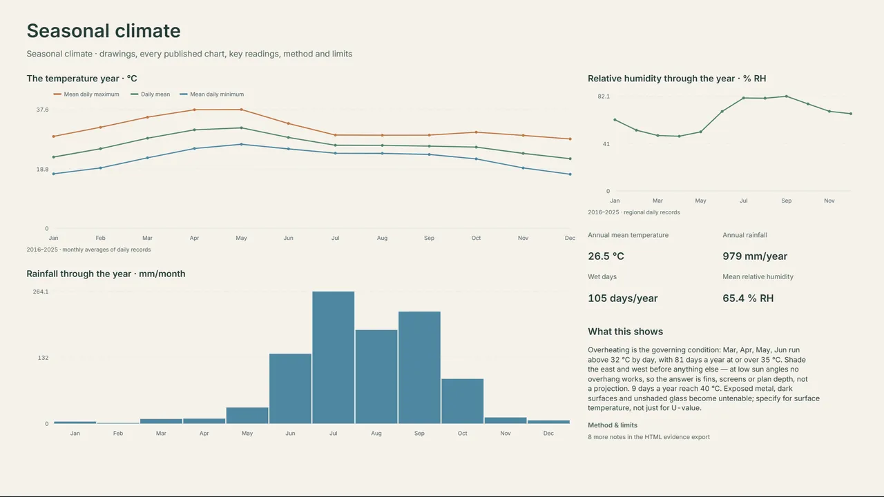
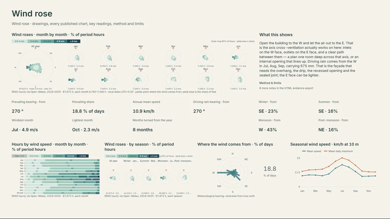
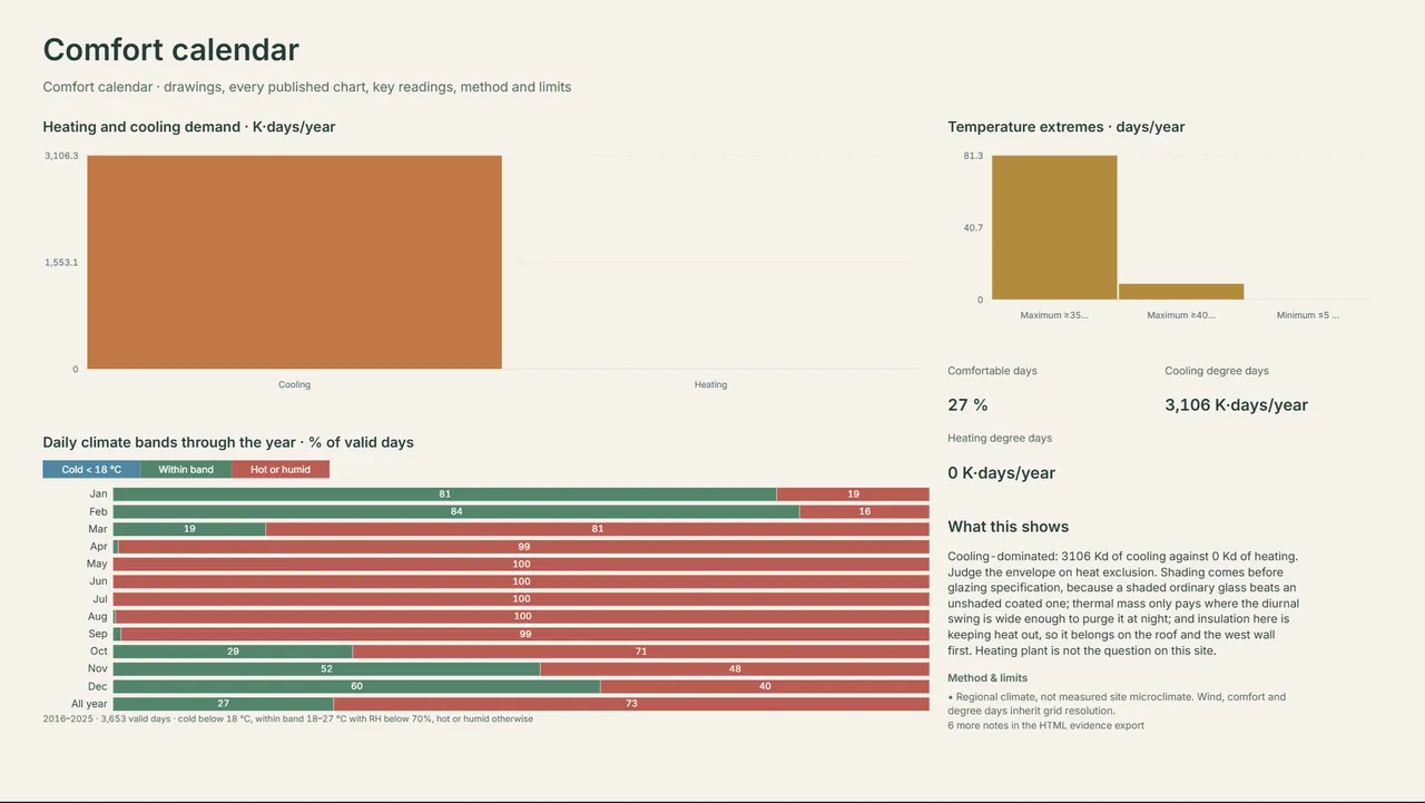
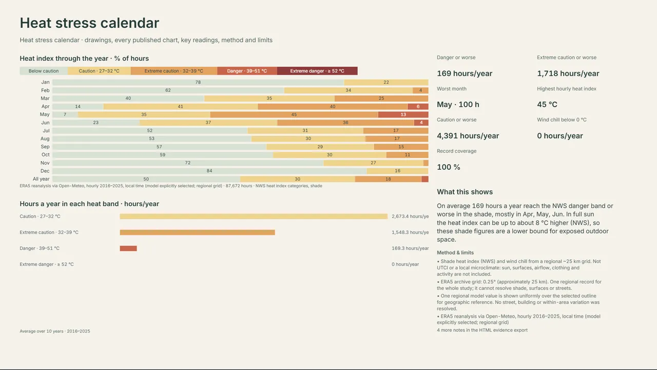
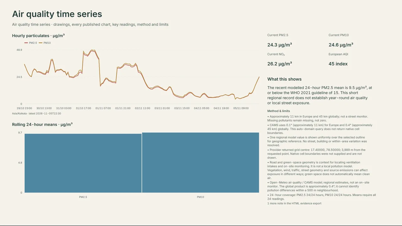
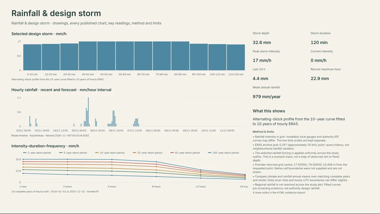
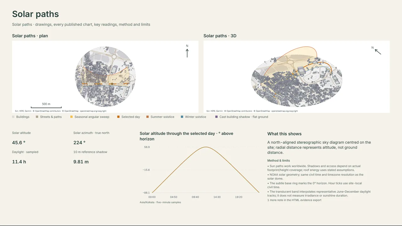
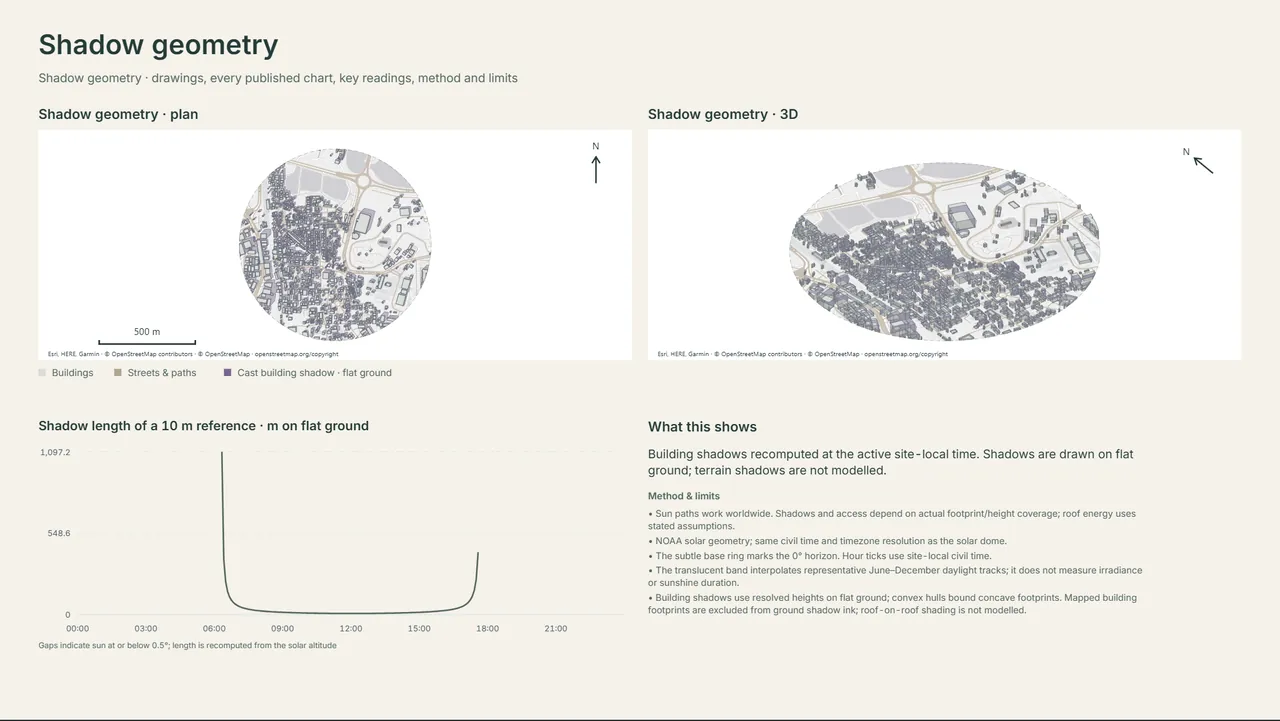
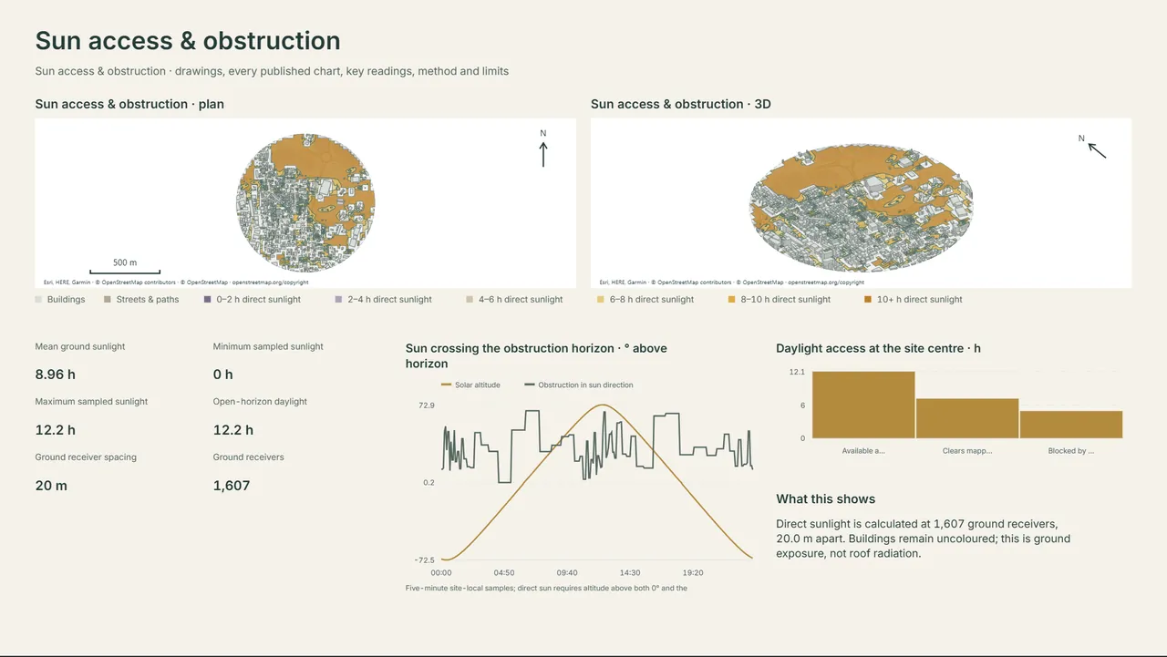
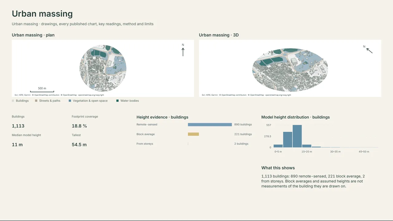
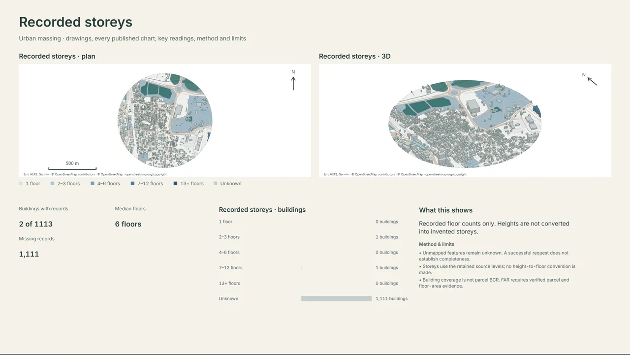
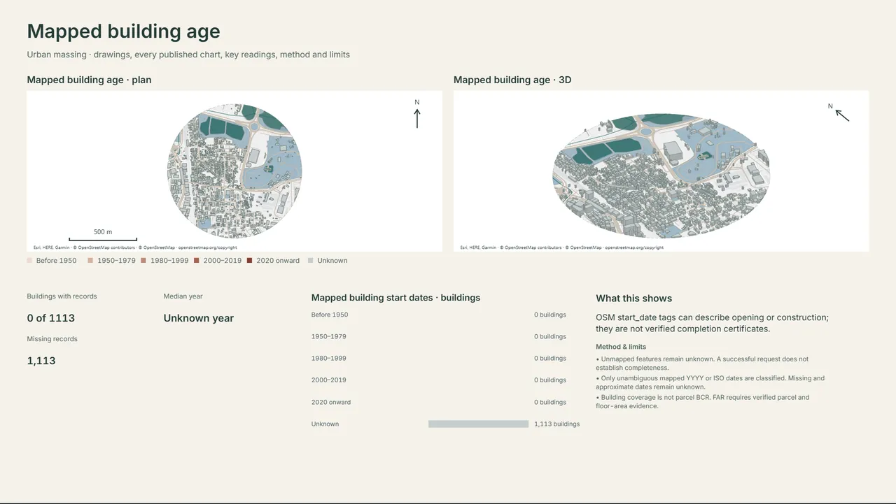
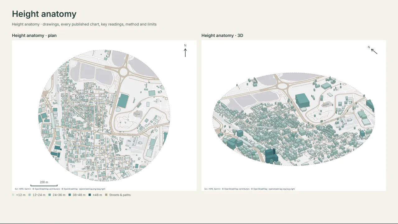
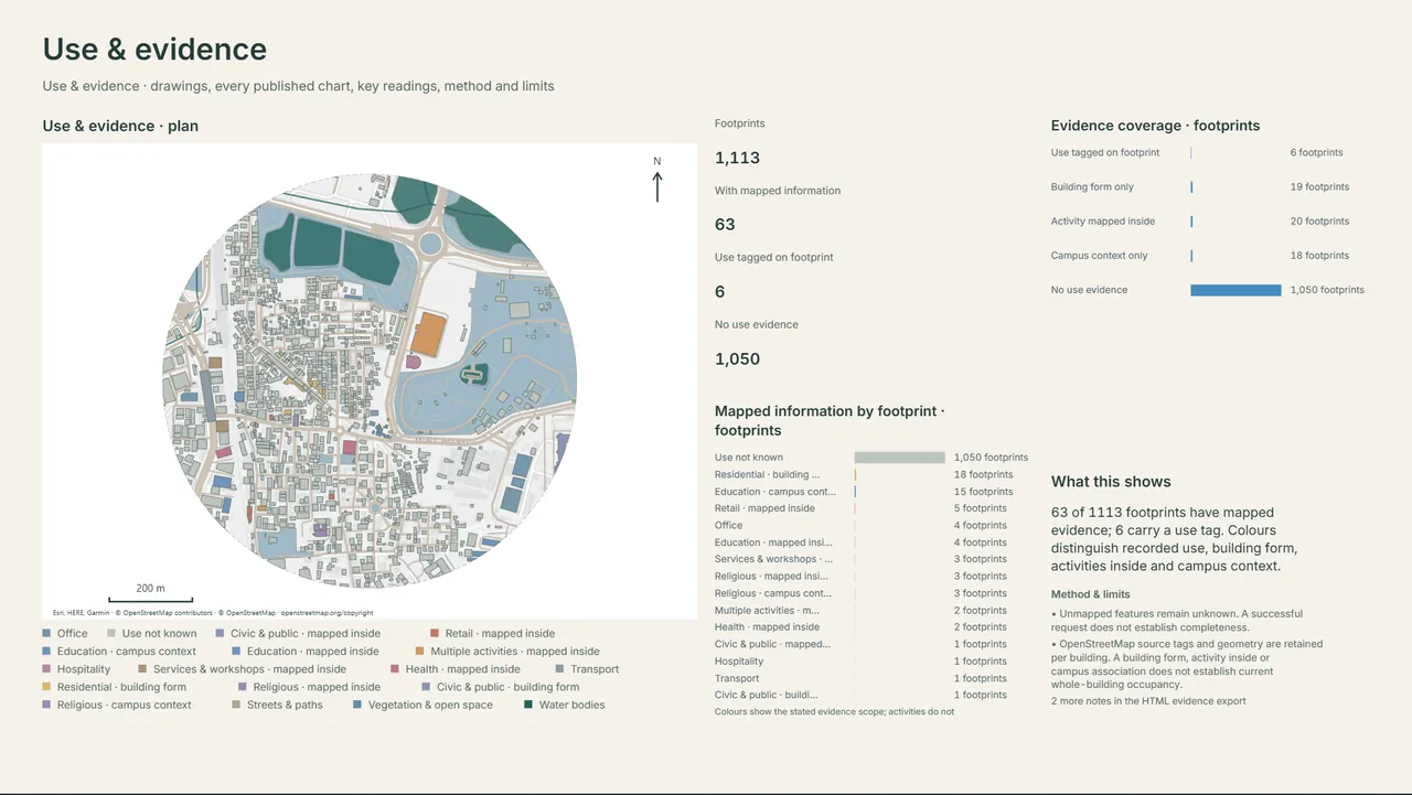
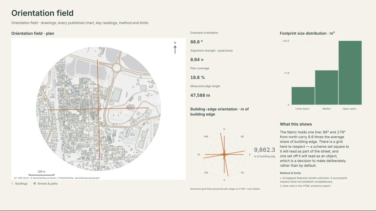
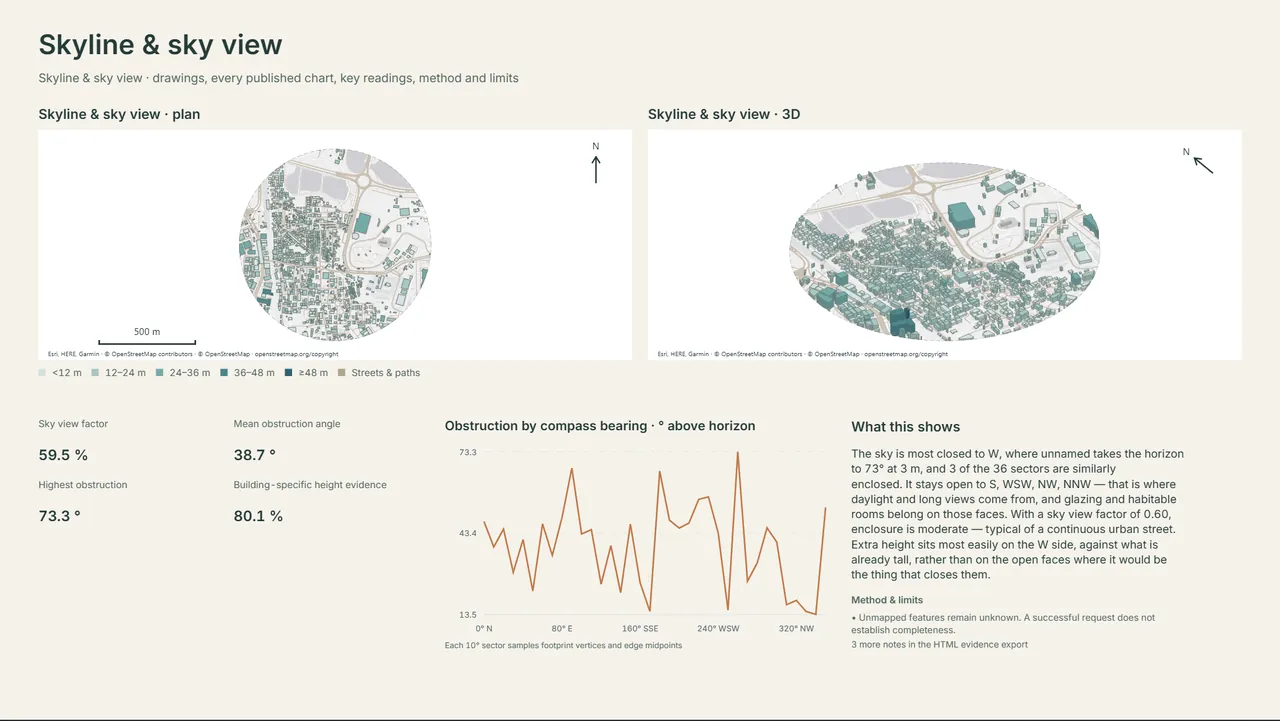
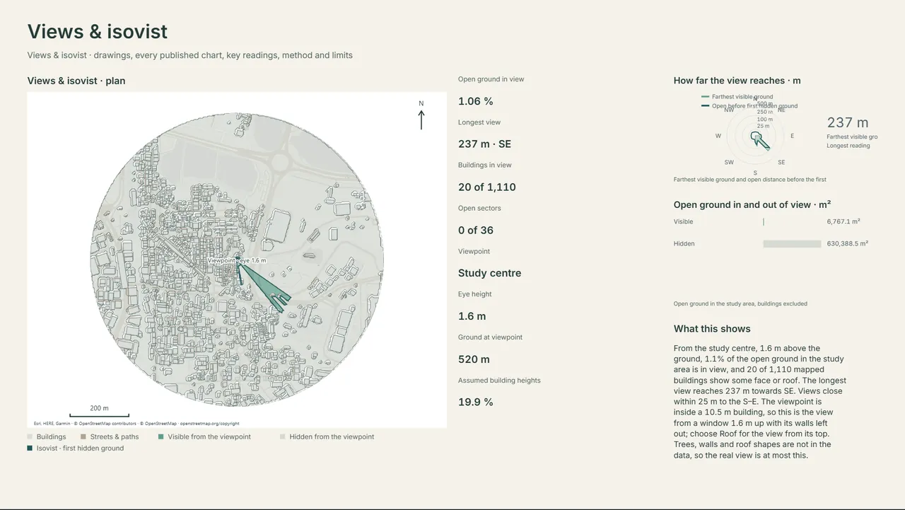
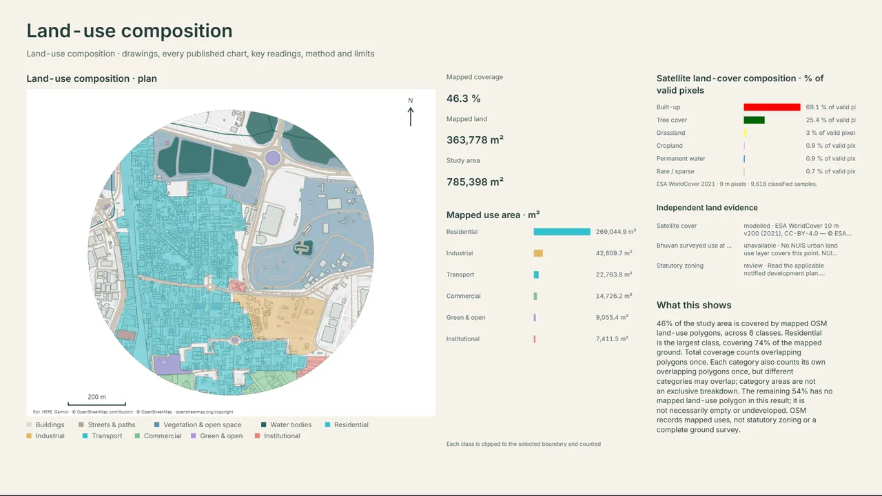
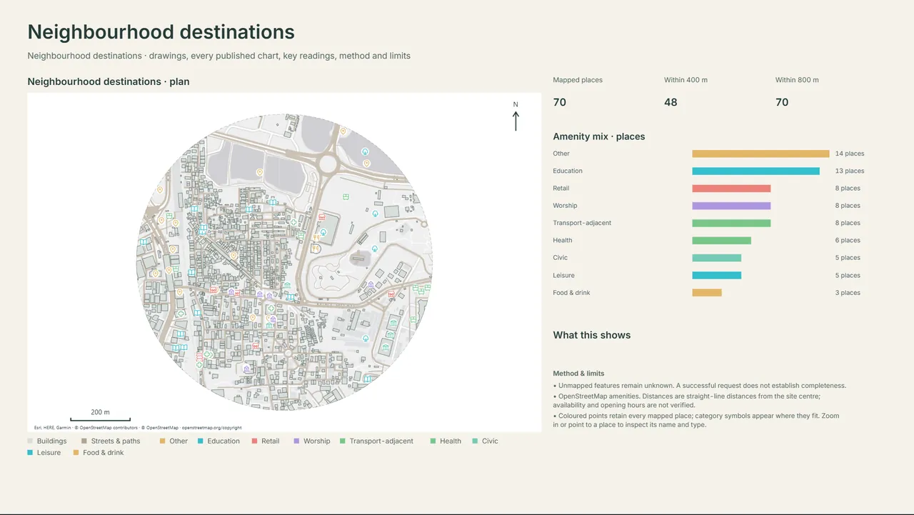
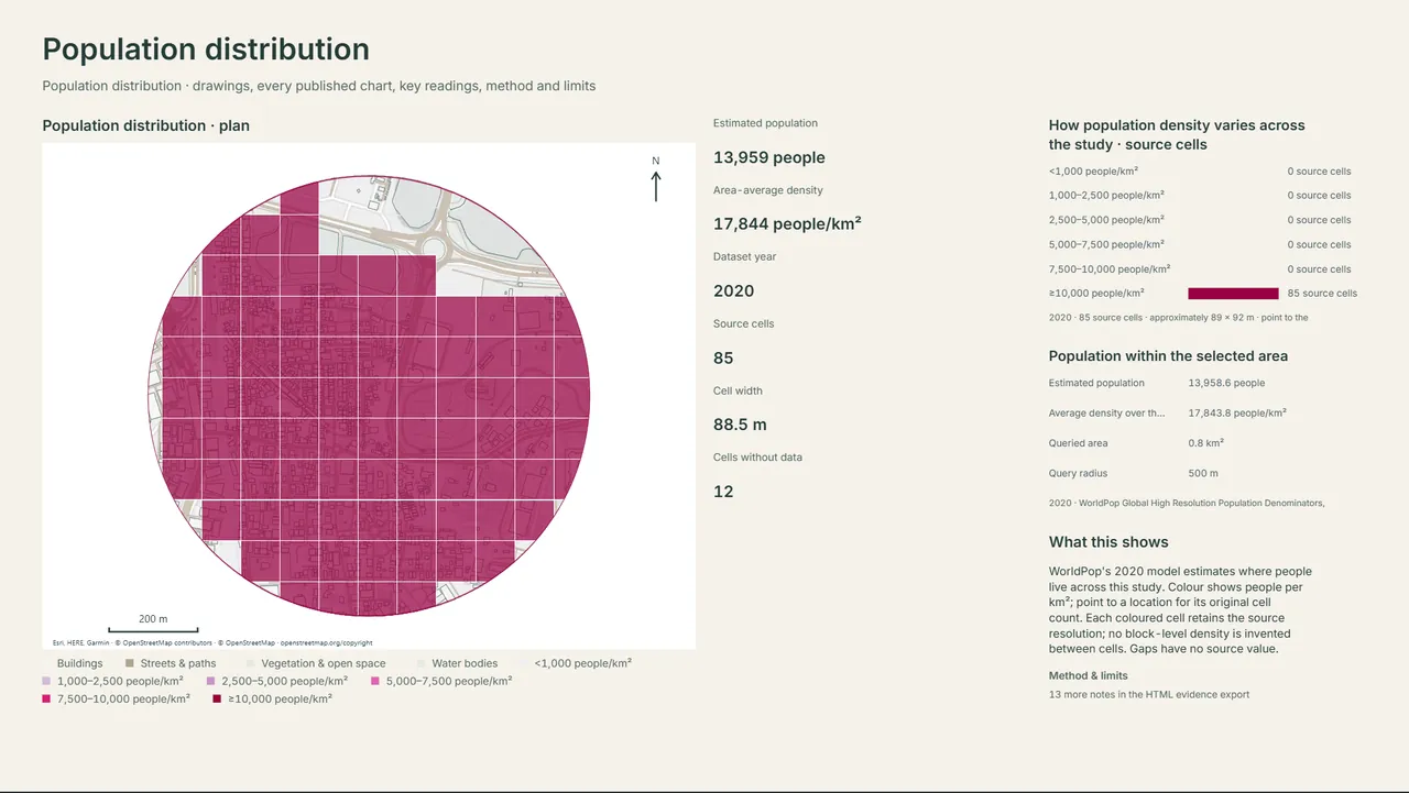
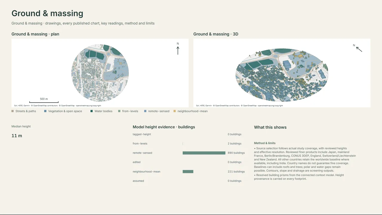
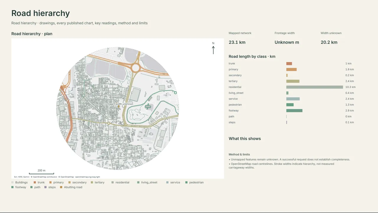
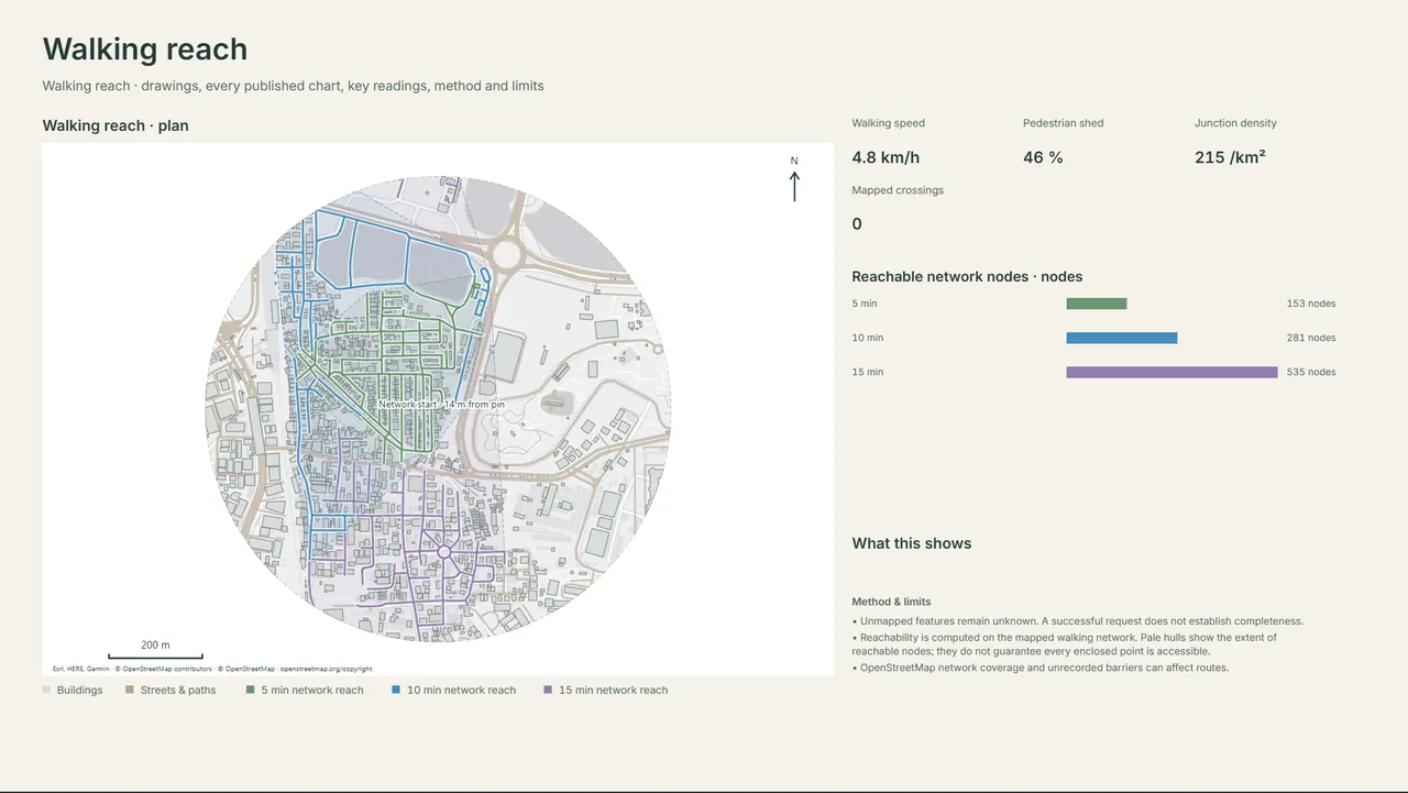
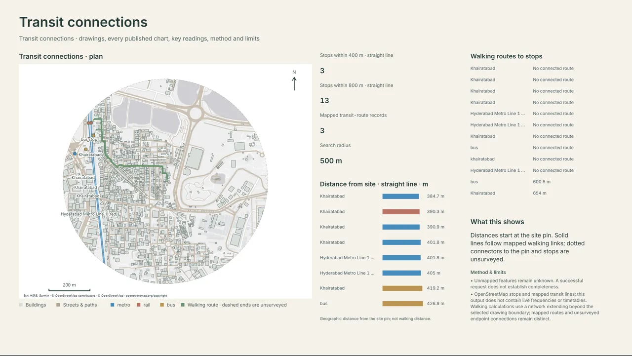
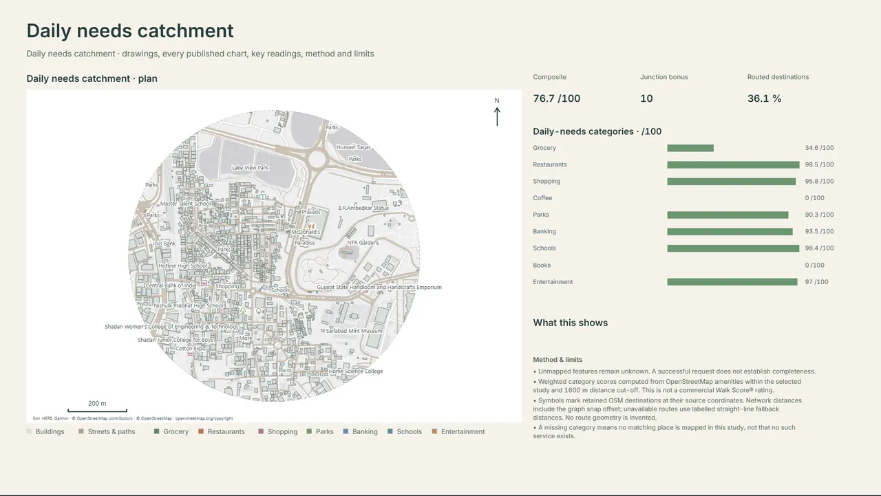
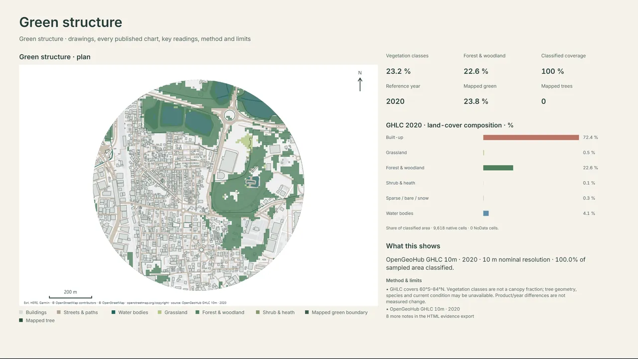
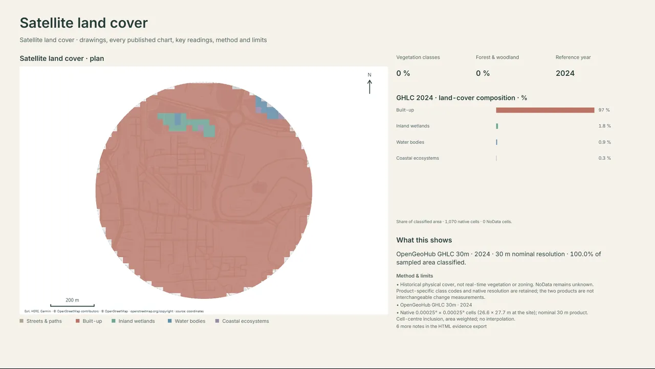
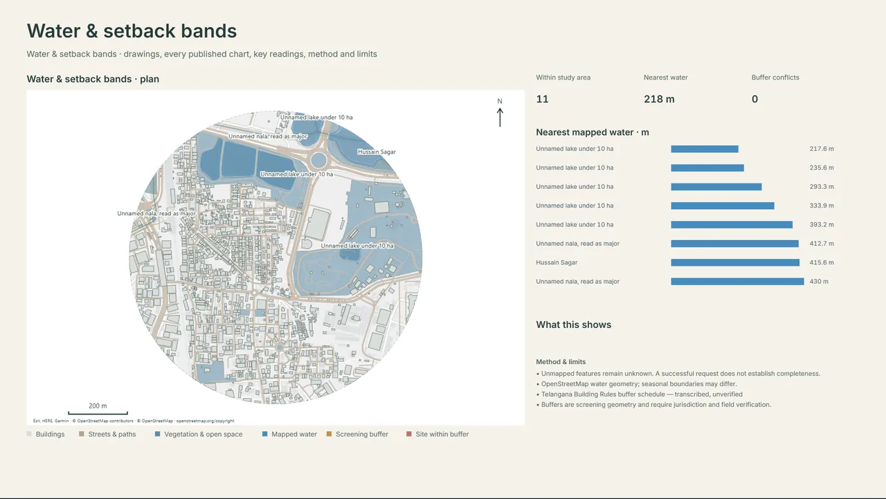
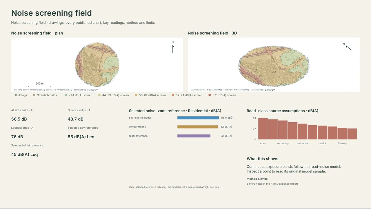
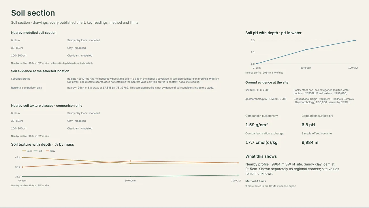
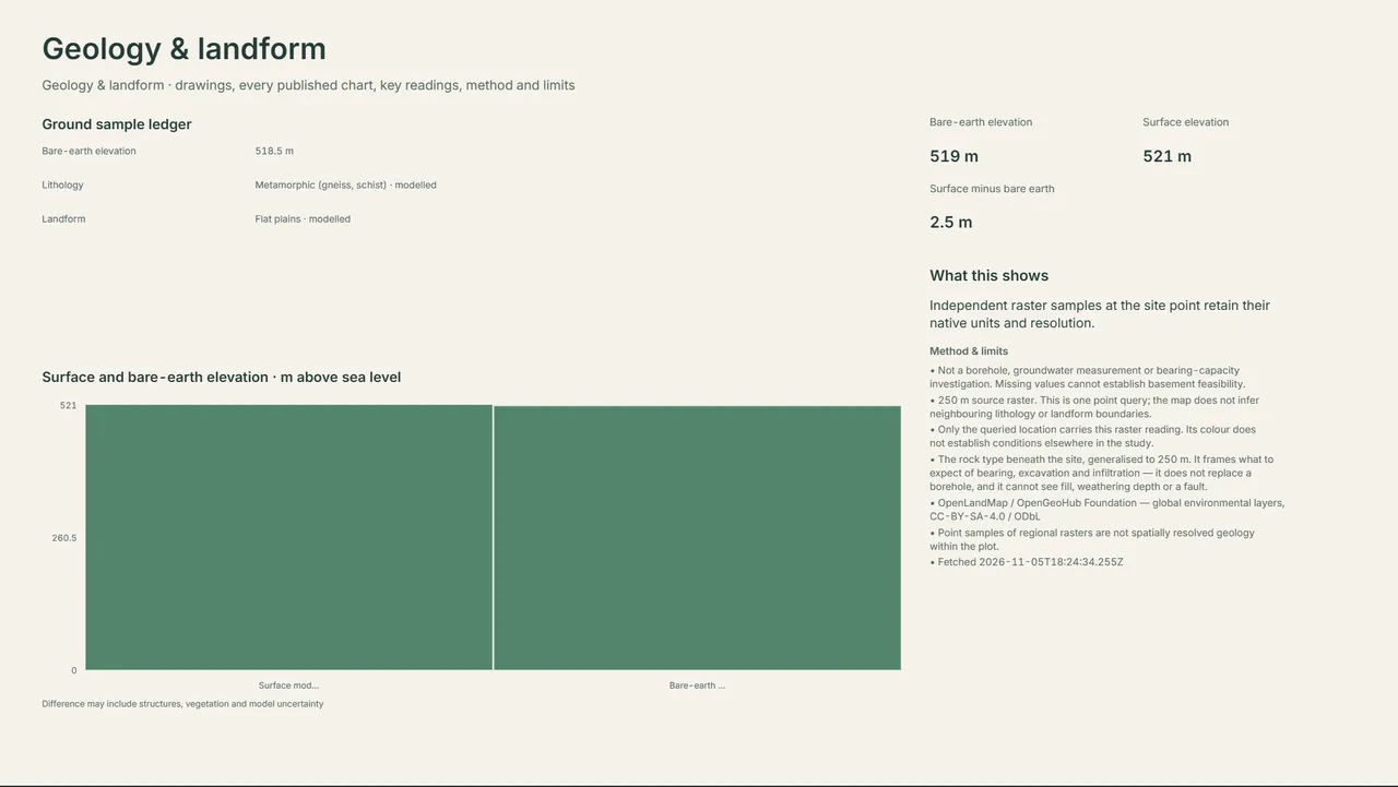
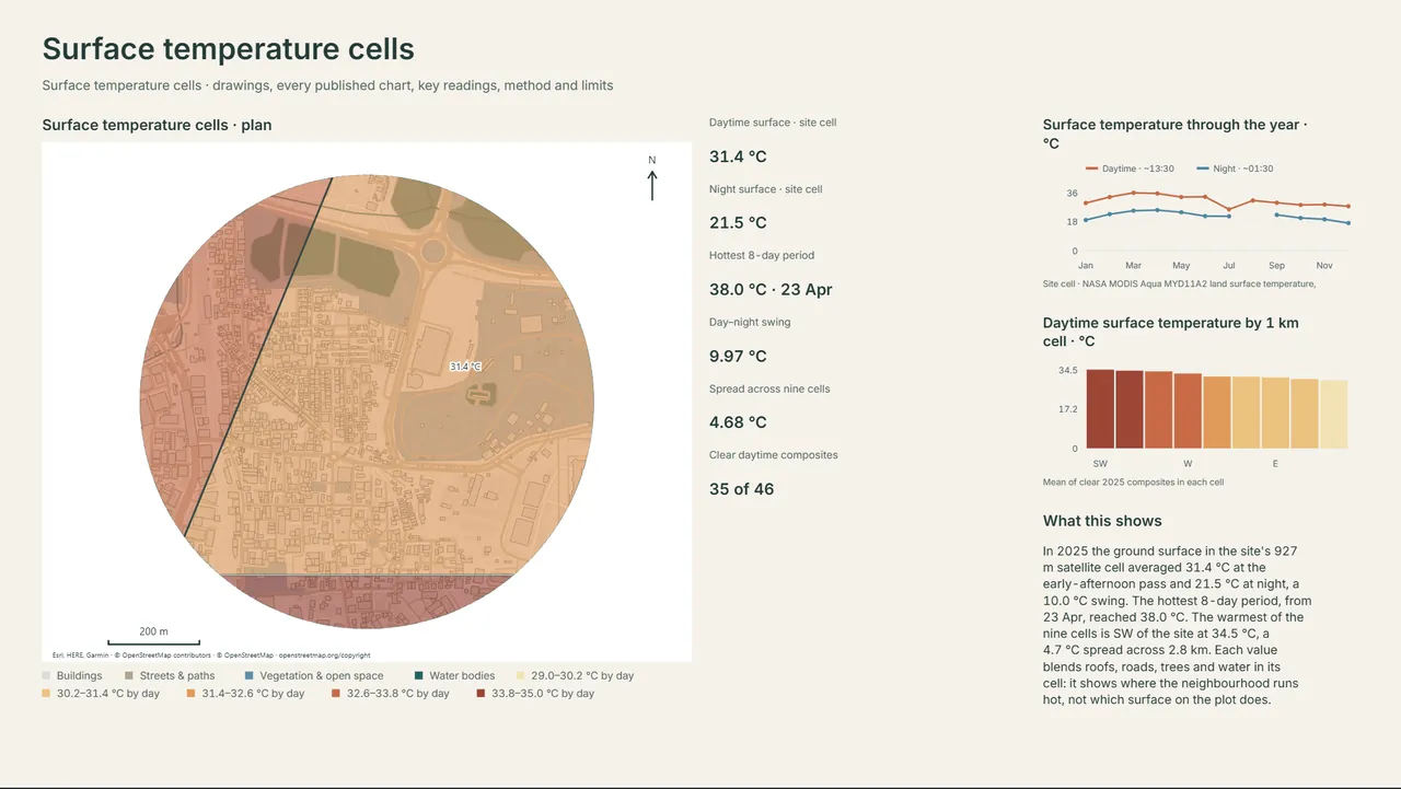
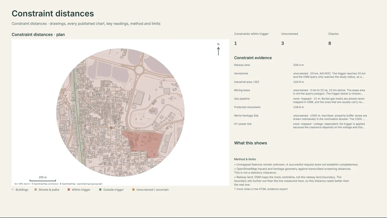
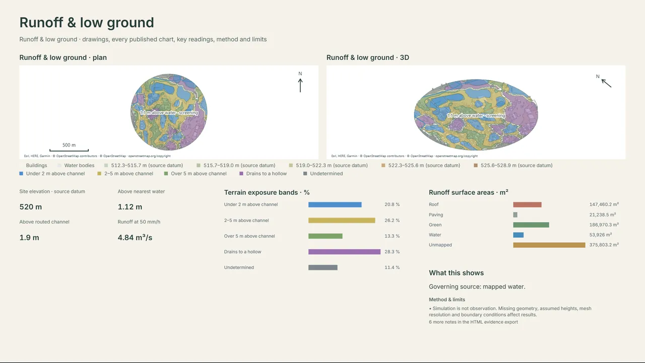
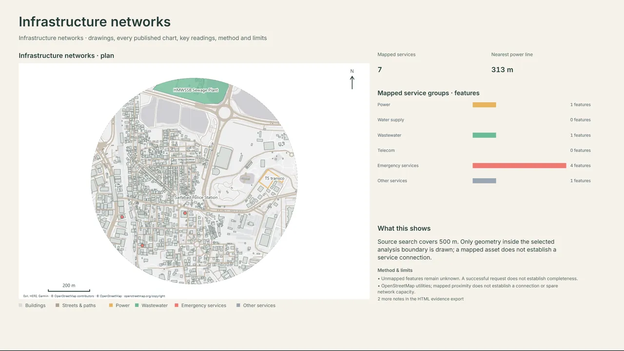
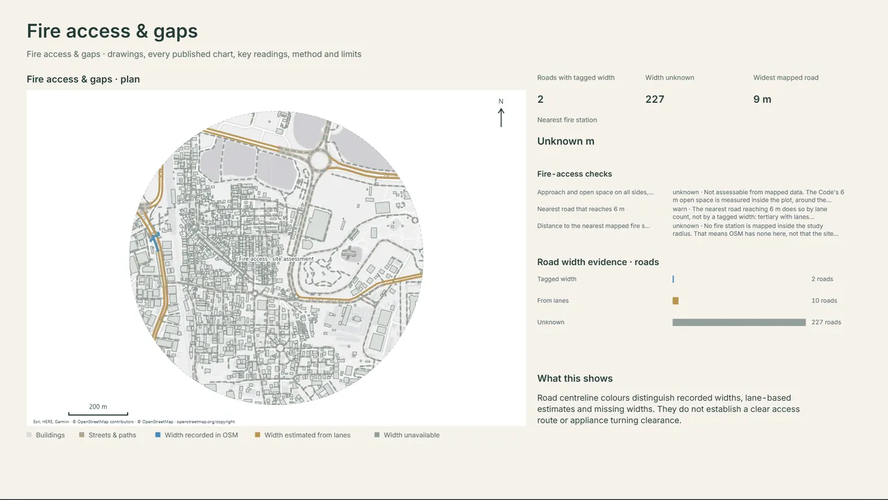
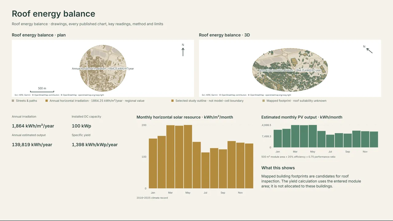
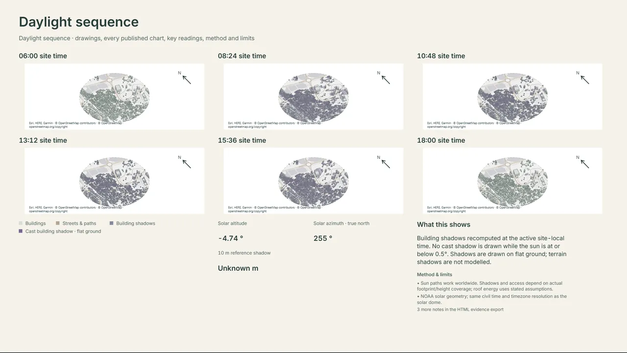
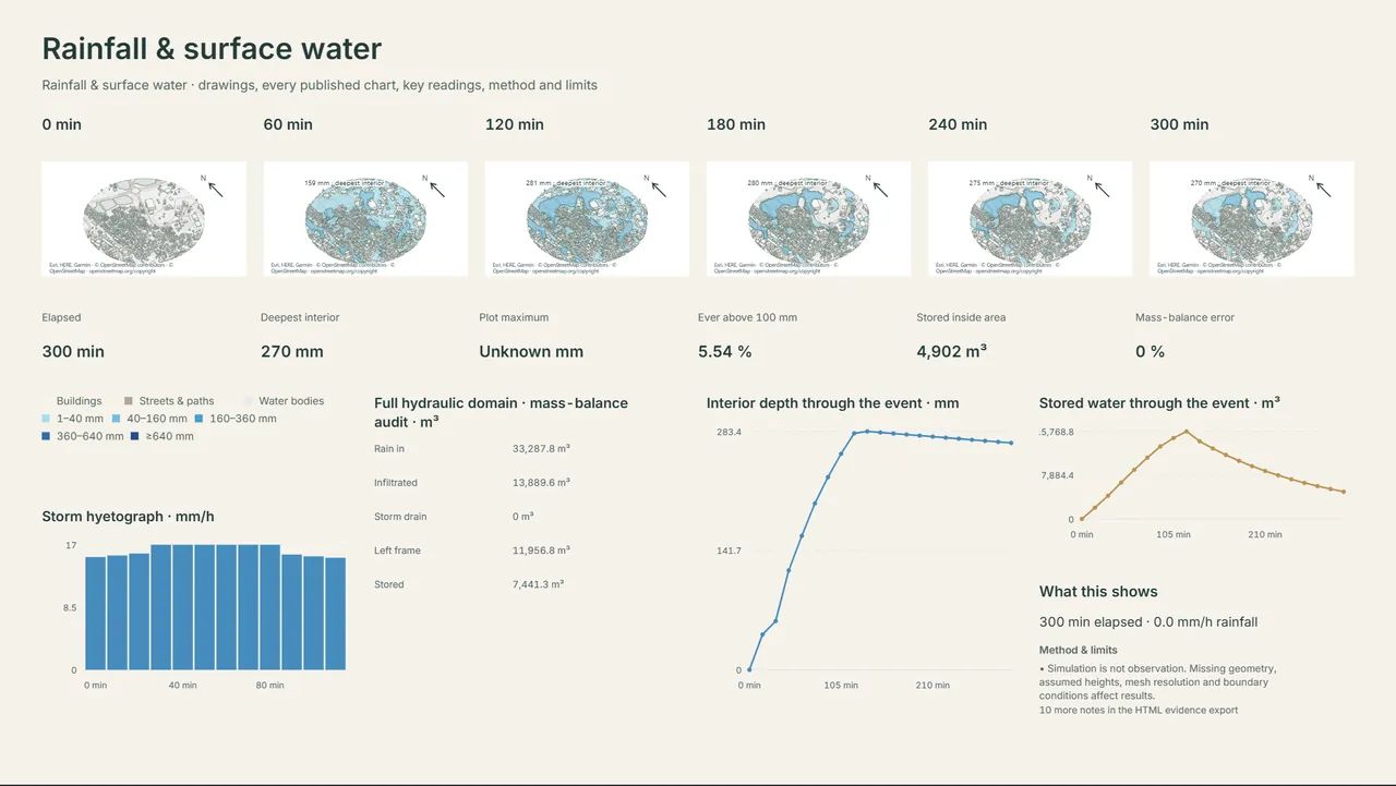
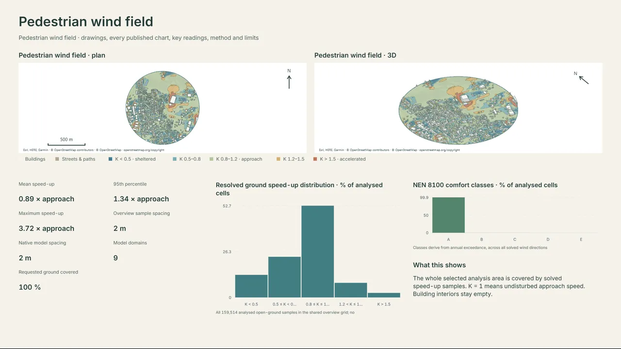
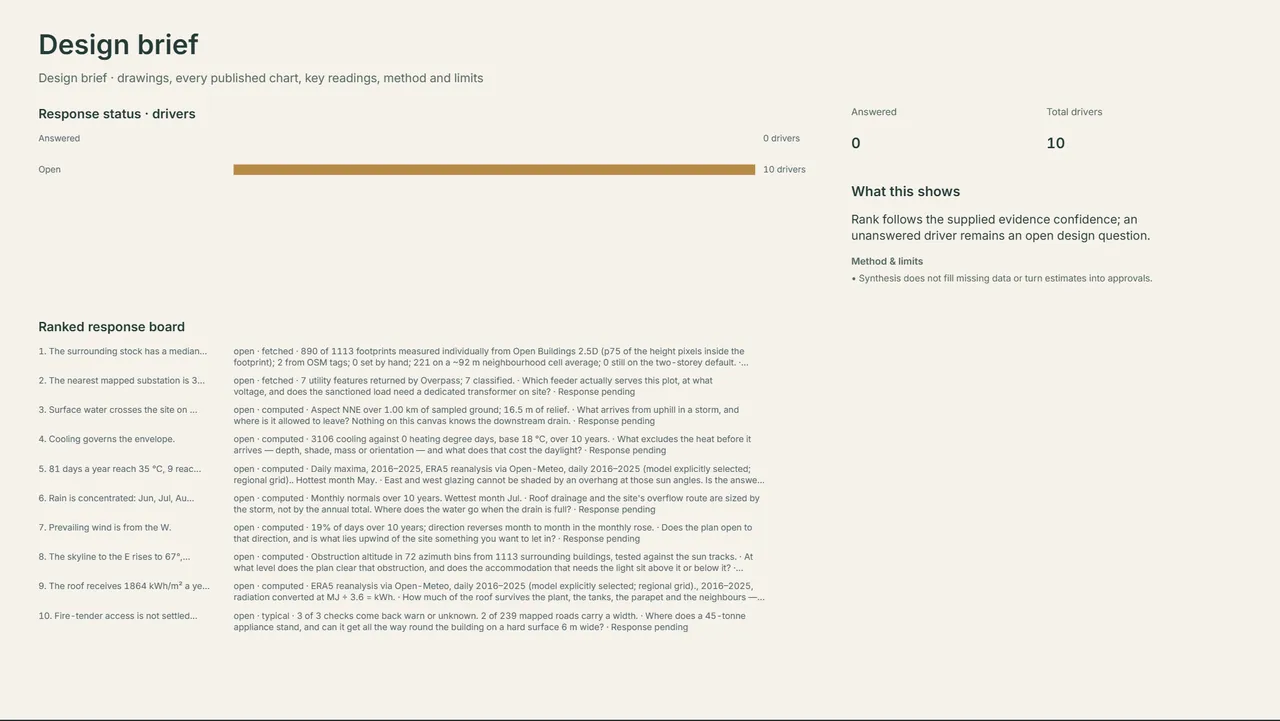
Get early accessEvery tile below came out of Site Intelligence on a 500 m study in Khairatabad, Hyderabad. Open any one to read it.
Map data © OpenStreetMap contributors and the sources credited in each study.
The same site, composed for three different jobs. Pick a depth, then change any map, colour or word.
A quick, clear picture of a site: location, climate, existing conditions, green, drainage and sun.
For a first client meeting or a feasibility note.
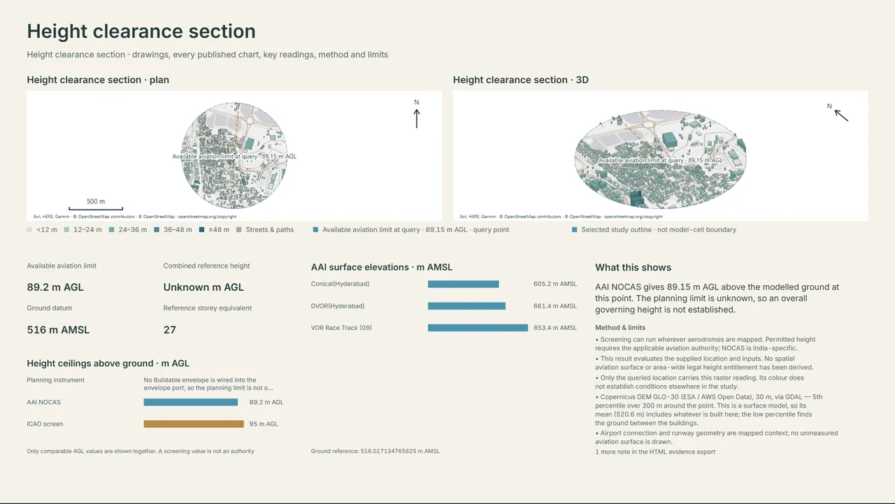
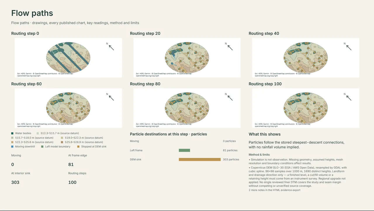
Coordinated plan and 3D studies, with access, heights, views, services, and wind and water sequences.
For a design stage presentation.
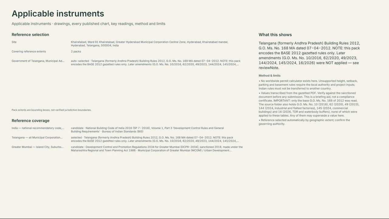
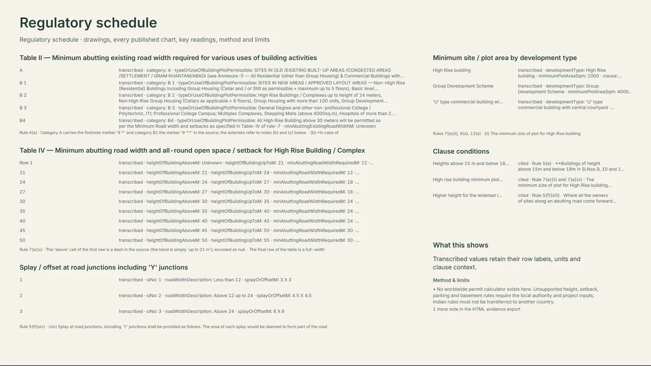
A cover and one full sheet per analysis, with its drawing, charts, readings and method notes.
For the project record and consultants.
Tell us the repeatable work you would hand to an agent first.
One location, one click, 49 analyses, and files your office can open. Site Intelligence is a working tool.